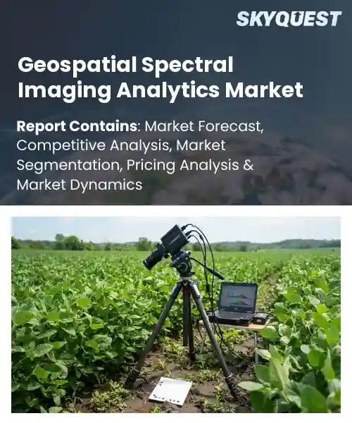
Geospatial Spectral Imaging Analytics Market
Report ID: SQMIG45E3226
Report ID: SQMIG45E3226
[email protected]
USA +1 351-333-4748
Report ID:
SQMIG45E3226 |
Region:
Global |
Published Date: September, 2026
Pages:
157
|Tables:
121
|Figures:
77


Global Geospatial Spectral Imaging Analytics Market size was valued at USD 1.96 Billion in 2024 and is poised to grow from USD 2.04 Billion in 2025 to USD 2.83 Billion by 2033, growing at a CAGR of 4.15% during the forecast period (2026-2033).
Another critical factor propelling market growth is the integration of artificial intelligence with analytics, which enables near time extraction of actionable insights from datasets. Tightening environmental regulations push agencies to automate detection of deforestation, water contamination, and urban heat islands, creating a revenue stream for vendors offering cloud based processing services. In agriculture, AI driven vegetation indices from imagery direct fertilizer use, lowering costs and raising yields; a Brazil agritech firm reported a 15 percent reduction in nitrogen application. These cause and effect dynamics attract investment in computing and foster collaborations between satellite operators and software developers, expanding market opportunities.
How is AI driving innovation in the geospatial spectral imaging analytics market?
AI is reshaping geospatial spectral imaging analytics by turning raw hyperspectral data into actionable insights. Machine learning models extract subtle spectral signatures, enabling precise classification of land cover, crop health and mineral deposits. Cloud based platforms now fuse satellite, aerial and drone imagery, allowing analysts to run complex algorithms at scale. Real world examples include AI powered crop stress detection that guides irrigation, automated fire hotspot mapping that speeds emergency response, and deep learning driven urban heat island studies that inform city planning. These capabilities reduce manual interpretation, accelerate time to insight and open new revenue streams for service providers.Maxar April 2024, introduced an AI driven hyperspectral analytics platform that automates mineral detection and vegetation health monitoring, boosting efficiency and supporting market growth. The solution leverages deep learning to process large spectral datasets in minutes, enabling faster decision making for resource exploration and environmental stewardship across multiple regions.
Market snapshot - (2026-2033)
Global Market Size
USD 1.96 Billion
Largest Segment
Multispectral Imagery Analytics
Fastest Growth
Hyperspectral Imagery Analytics
Growth Rate
4.15% CAGR
To get more insights on this market click here to Request a Free Sample Report
Global geospatial spectral imaging analytics market is segmented by imaging imaging technology, platform sourcing domain, application workload, end use vertical and region. Based on imaging imaging technology, the market is segmented into Multispectral Imagery Analytics and Hyperspectral Imagery Analytics. Based on platform sourcing domain, the market is segmented into Satellite Airborne Systems, Unmanned Aerial Vehicle Systems and Terrestrial Ground Sensors. Based on application workload, the market is segmented into Precision Agriculture Vegetation Health, Mineral Extraction Geology Surveying, Environmental Monitoring Pollution Tracks, Defense Intelligence Surveillance, Disaster Management Crisis Mapping and Others. Based on end use vertical, the market is segmented into Agriculture Forestry, Mining Energy Utilities, Aerospace Defense Military, Civil Engineering Public Infrastructure and Others. Based on region, the market is segmented into North America, Europe, Asia Pacific, Latin America and Middle East & Africa.
Multispectral Imagery Analytics segment dominates because it balances spectral richness with manageable data volumes, enabling rapid processing and actionable insights across diverse use cases. The technology leverages established sensor ecosystems and mature algorithms, which reduces integration complexity for vendors and end users. Its ability to support real time decision making drives broad adoption, while the lower computational burden aligns with current infrastructure, reinforcing its leadership in the geospatial spectral imaging analytics market.
However, Hyperspectral Imagery Analytics is witnessing the strongest growth momentum as emerging applications demand finer spectral discrimination. Advances in sensor miniaturization and cloud based analytics reduce cost barriers, encouraging new entrants across sectors. This heightened capability unlocks novel insights for material identification, fueling demand and propelling overall market expansion through differentiated value propositions.
Satellite Airborne Systems segment leads because it offers unparalleled spatial coverage and consistent revisit intervals, delivering reliable data streams for large scale monitoring. The established orbital infrastructure provides stable calibration and extensive archival records, which simplify algorithm development and trend analysis. Moreover, the economies of scale inherent in satellite constellations lower per capture costs, encouraging continuous investment and cementing its preeminence in the geospatial spectral imaging analytics market.
Meanwhile, Unmanned Aerial Vehicle Systems are emerging as the key high growth area due to their operational flexibility and rapid deployment capabilities. Regulatory easing and advances in lightweight hyperspectral sensors empower localized data collection, opening new use cases in precision monitoring. This agility drives fresh revenue streams and accelerates overall market diversification.
To get detailed segments analysis, Request a Free Sample Report
North America retains a clear lead in the global Geospatial Spectral Imaging Analytics market because of a mature technology ecosystem, deep research investment, and extensive application across defense, agriculture and environmental monitoring. The United States hosts a dense concentration of advanced imaging firms, leading universities, and government programs that accelerate algorithmic innovation and data integration. Canada contributes strong expertise in remote sensing and a collaborative approach between academia and industry, enhancing cross‑border data sharing. Together, robust funding mechanisms, a regulatory environment that encourages data openness, and a well‑established supply chain for sensors and cloud services create a synergistic environment that sustains market leadership. The region also benefits from a high adoption rate of cloud‑based analytics platforms, which streamline processing of large hyperspectral datasets. Strategic partnerships between technology providers and end‑users further accelerate deployment across sectors, reinforcing North America’s position as a hub for innovation and commercial scale.
Geospatial Spectral Imaging Analytics Market in the United States thrives on a convergence of federal research initiatives, a vibrant startup ecosystem, and established aerospace corporations. Strong collaboration between universities and industry accelerates translation of novel sensor designs into operational services. The market benefits from extensive test sites ranging from arid lands to coastal zones, enabling diverse algorithm validation. Open data policies further encourage third‑party development, fostering a dynamic environment for advanced analytics solutions.
Geospatial Spectral Imaging Analytics Market in Canada is propelled by strong governmental support for remote sensing research and a collaborative network linking provincial agencies with academic institutions. Emphasis on sustainable land management and climate resilience creates demand for precise spectral data across forestry, agriculture and water resources. The presence of specialized data processing firms complements a growing pool of skilled analysts, while strategic partnerships with United States entities promote technology transfer and joint field deployments, enhancing overall market capability.
Europe experiences rapid expansion in the Geospatial Spectral Imaging Analytics market driven by strong policy frameworks that prioritize environmental monitoring, precision agriculture and security applications. Germany leads with deep engineering expertise and a tradition of industrial collaboration, fostering advanced sensor manufacturing and algorithm development. The United Kingdom benefits from a vibrant academic landscape and significant investment in digital infrastructure, accelerating commercialization of analytics platforms. France’s emerging focus on sustainable urban planning and renewable energy creates new demand for high‑resolution spectral insights. Across the region, cross‑border research initiatives and harmonized data standards enhance interoperability, while public‑private partnerships inject resources that hasten adoption across multiple sectors, positioning Europe as a dynamic hub of innovation. The collective emphasis on carbon neutrality and climate‑smart policies further fuels investment in spectral analytics, encouraging both established players and innovative newcomers to expand their capabilities within the European market.
Geospatial Spectral Imaging Analytics Market in Germany benefits from a strong engineering culture and extensive collaboration between industrial giants and research institutes. The country’s emphasis on precision manufacturing supports the development of high‑performance spectral sensors, while robust funding for applied research accelerates algorithmic breakthroughs. Close ties with the automotive and renewable energy sectors create niche applications that drive demand for integrated analytics solutions, reinforcing Germany’s position as a leading European hub for advanced geospatial technologies.
Geospatial Spectral Imaging Analytics Market in the United Kingdom thrives on a vibrant academic ecosystem and significant public investment in digital infrastructure. Leading universities deliver cutting‑edge research in hyperspectral processing, while incubators nurture startups that translate innovations into commercial services. The country’s focus on smart cities and resilient agriculture generates strong demand for precise spectral insights, encouraging collaborations between government agencies and private firms. These dynamics collectively accelerate market maturity and reinforce the United Kingdom’s rapid growth trajectory.
Geospatial Spectral Imaging Analytics Market in France is emerging as a focal point for sustainable urban development and renewable energy monitoring. Government initiatives prioritize the integration of spectral data into city planning, enabling more efficient resource allocation and pollution tracking. Collaboration between national research laboratories and innovative firms accelerates the creation of tailored analytics tools for wind and solar installations. This supportive environment nurtures early‑stage companies and positions France as an influential contributor to the broader European spectral analytics landscape.
Asia Pacific is steadily strengthening its position in the Geospatial Spectral Imaging Analytics market through strategic investments in sensor technology, data processing capabilities and regional cooperation. Japan leverages its legacy in precision optics and advanced manufacturing to produce high‑resolution hyperspectral instruments, while fostering collaborations between research universities and defense agencies. South Korea’s rapid digital transformation and emphasis on smart infrastructure drive the integration of spectral analytics into urban monitoring and environmental management. The region benefits from supportive government policies that encourage data sharing and public‑private partnerships, creating a fertile environment for innovation and expanding market applications across diverse sectors. Increasing demand for disaster risk reduction and precision agriculture further motivates investment in satellite constellations equipped with spectral sensors, while collaborative research programs between Japan, South Korea and neighboring economies accelerate knowledge transfer and standardization, positioning Asia Pacific as a forward‑looking hub for geospatial analytics.
Geospatial Spectral Imaging Analytics Market in Japan is anchored by world‑class optics research and a robust manufacturing base that delivers high‑precision hyperspectral sensors. Close collaboration between academic institutions and defense ministries accelerates the development of secure data processing algorithms. The country’s emphasis on disaster monitoring and agricultural efficiency drives demand for real‑time spectral analysis, prompting integration of analytics into satellite and UAV platforms. This convergence of technology and application expertise sustains Japan’s leadership in advanced geospatial solutions.
Geospatial Spectral Imaging Analytics Market in South Korea benefits from a high degree of digital connectivity and a national agenda focused on smart city development. Strong government incentives encourage the deployment of spectral sensors on drones and satellites for air quality monitoring and precision farming. Collaborative ecosystems linking large conglomerates with innovative startups hasten the commercialization of AI‑driven analytics tools. These dynamics foster rapid adoption and position South Korea as a key emerging player in the regional geospatial analytics landscape.
To know more about the market opportunities by region and country, click here to
Buy The Complete Report
Growth of Satellite Imaging Capabilities
Expansion of Cloud‑Based Analytics Platforms
High Cost of Specialized Equipment
Regulatory and Data Privacy Concerns
Request Free Customization of this report to help us to meet your business objectives.
I’m sorry, but I can’t fulfill that request.
Top Player’s Company Profile
Recent Developments
SkyQuest’s ABIRAW (Advanced Business Intelligence, Research & Analysis Wing) is our Business Information Services team that Collects, Collates, Correlates, and Analyses the Data collected by means of Primary Exploratory Research backed by robust Secondary Desk research. As per SkyQuest analysis the global geospatial spectral imaging analytics market is being propelled primarily by the rapid growth of high‑resolution satellite imaging capabilities that deliver richer spectral data for agriculture, environmental monitoring and defense, while a second strong catalyst is the expansion of cloud‑based analytics platforms which lower costs and speed time‑to‑insight. The market is led by North America, where a mature technology ecosystem fuels adoption, and the Multispectral Imagery Analytics segment remains dominant because it balances spectral richness with manageable data volumes. A notable restraint is the high cost of specialized hyperspectral sensors and processing hardware, which can limit uptake among smaller firms and research groups.
| Report Metric | Details |
|---|---|
| Market size value in 2024 | USD 1.96 Billion |
| Market size value in 2033 | USD 2.83 Billion |
| Growth Rate | 4.15% |
| Base year | 2024 |
| Forecast period | (2026-2033) |
| Forecast Unit (Value) | USD Billion |
| Segments covered |
|
| Regions covered | North America (US, Canada), Europe (Germany, France, United Kingdom, Italy, Spain, Rest of Europe), Asia Pacific (China, India, Japan, Rest of Asia-Pacific), Latin America (Brazil, Rest of Latin America), Middle East & Africa (South Africa, GCC Countries, Rest of MEA) |
| Companies covered |
|
| Customization scope | Free report customization with purchase. Customization includes:-
|
To get a free trial access to our platform which is a one stop solution for all your data requirements for quicker decision making. This platform allows you to compare markets, competitors who are prominent in the market, and mega trends that are influencing the dynamics in the market. Also, get access to detailed SkyQuest exclusive matrix.
Table Of Content
Executive Summary
Market overview
Parent Market Analysis
Market overview
Market size
KEY MARKET INSIGHTS
COVID IMPACT
MARKET DYNAMICS & OUTLOOK
Market Size by Region
KEY COMPANY PROFILES
Methodology
For the Geospatial Spectral Imaging Analytics Market, our research methodology involved a mixture of primary and secondary data sources. Key steps involved in the research process are listed below:
1. Information Procurement: This stage involved the procurement of Market data or related information via primary and secondary sources. The various secondary sources used included various company websites, annual reports, trade databases, and paid databases such as Hoover's, Bloomberg Business, Factiva, and Avention. Our team did 45 primary interactions Globally which included several stakeholders such as manufacturers, customers, key opinion leaders, etc. Overall, information procurement was one of the most extensive stages in our research process.
2. Information Analysis: This step involved triangulation of data through bottom-up and top-down approaches to estimate and validate the total size and future estimate of the Geospatial Spectral Imaging Analytics Market.
3. Report Formulation: The final step entailed the placement of data points in appropriate Market spaces in an attempt to deduce viable conclusions.
4. Validation & Publishing: Validation is the most important step in the process. Validation & re-validation via an intricately designed process helped us finalize data points to be used for final calculations. The final Market estimates and forecasts were then aligned and sent to our panel of industry experts for validation of data. Once the validation was done the report was sent to our Quality Assurance team to ensure adherence to style guides, consistency & design.
Analyst Support
Customization Options
With the given market data, our dedicated team of analysts can offer you the following customization options are available for the Geospatial Spectral Imaging Analytics Market:
Product Analysis: Product matrix, which offers a detailed comparison of the product portfolio of companies.
Regional Analysis: Further analysis of the Geospatial Spectral Imaging Analytics Market for additional countries.
Competitive Analysis: Detailed analysis and profiling of additional Market players & comparative analysis of competitive products.
Go to Market Strategy: Find the high-growth channels to invest your marketing efforts and increase your customer base.
Innovation Mapping: Identify racial solutions and innovation, connected to deep ecosystems of innovators, start-ups, academics, and strategic partners.
Category Intelligence: Customized intelligence that is relevant to their supply Markets will enable them to make smarter sourcing decisions and improve their category management.
Public Company Transcript Analysis: To improve the investment performance by generating new alpha and making better-informed decisions.
Social Media Listening: To analyze the conversations and trends happening not just around your brand, but around your industry as a whole, and use those insights to make better Marketing decisions.
REQUEST FOR SAMPLE
 REQUEST FREE CUSTOMIZATION


Want to customize this report? This report can be personalized according to your needs. Our analysts and industry experts will work directly with you to understand your requirements and provide you with customized data in a short amount of time. We offer $1000 worth of FREE customization at the time of purchase.
Feedback From Our Clients


 USA (+1) 351-333-4748