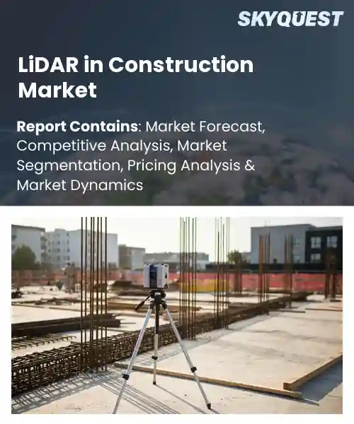
LiDAR in Construction Market
Report ID: SQMIG45I2418
Report ID: SQMIG45I2418
[email protected]
USA +1 351-333-4748
Report ID:
SQMIG45I2418 |
Region:
Global |
Published Date: June, 2026
Pages:
157
|Tables:
140
|Figures:
78


Global Lidar In Construction Market size was valued at USD 807.5 Million in 2024 and is poised to grow from USD 870.49 Million in 2025 to USD 1587.49 Million by 2033, growing at a CAGR of 7.8% during the forecast period (2026-2033).
The primary driver of the LiDAR in construction market is the industry’s demand for precise as built information that reduces rework and accelerates delivery of projects. LiDAR systems such as terrestrial scanners, mobile mapping rigs and airborne sensors capture dense three dimensional point clouds which replace manual measurement and support design, verification and regulatory compliance. Over the last decade adoption moved beyond specialist surveyors to contractors and owners because sensors became lighter, processing improved and BIM and GIS integration matured. Practical examples include drone surveys for topography, vehicle based corridor mapping for highways, and scanner captures for prefabrication verification accuracy.
As adoption expanded among contractors and owners, falling sensor costs and the convergence of LiDAR with drones, AI and BIM produced efficiency gains that drove further investment. Lower hardware prices and cloud processing reduced survey cycle time, so teams could perform weekly progress scans that cut schedule risk and enable early clash detection. For example, a highway contractor using vehicle LiDAR reduced corridor design errors and cut earthwork rework, while a bridge owner used periodic scans to detect millimeter scale deflection and prioritize maintenance. Consequently vendors pivot toward subscription analytics, creating opportunities in digital twins, infrastructure renewal and retrofit markets.
How is AI enhancing Lidar adoption in the construction market?
LiDAR captures dense three dimensional point clouds that describe site geometry. AI enhances LiDAR by automating point classification and object detection, filtering noise and producing as built models for progress tracking. In the current construction market contractors are adopting LiDAR where AI cuts manual processing and turns raw scans into actionable deliverables. This raises safety and predictability because AI supports early clash detection and feeds digital twin workflows that link surveys to scheduling and quality control. Examples include suppliers embedding edge AI into surveying instruments and software partners adding conversational and modeling AI to speed engineering workflows.
Leica Geosystems February 2026, introduced Xsight360 using edge AI to fuse LiDAR and visual sensing for real time risk detection and operator alerting, helping contractors adopt LiDAR by lowering setup complexity and reducing rework through automated monitoring of as built conditions.
Market snapshot - (2026-2033)
Global Market Size
USD 807.5 Million
Largest Segment
3D LiDAR
Fastest Growth
3D LiDAR
Growth Rate
7.8% CAGR
To get more insights on this market click here to Request a Free Sample Report
Global lidar in construction market is segmented by lidar technology type, application area, deployment model, end-user industry, service type and region. Based on lidar technology type, the market is segmented into 3D LiDAR and 2D LiDAR. Based on application area, the market is segmented into Site Surveying, Progress Monitoring and Construction Safety. Based on deployment model, the market is segmented into On-site LiDAR and UAV-based LiDAR. Based on end-user industry, the market is segmented into Residential Construction and Commercial Construction. Based on service type, the market is segmented into Data Processing Services and Consulting Services. Based on region, the market is segmented into North America, Europe, Asia Pacific, Latin America and Middle East & Africa.
3D LiDAR segment dominates because it provides dense, high-fidelity point clouds that capture complex building geometries and site topography, enabling precise as-built modeling and seamless integration with BIM and CAD workflows. This level of spatial detail reduces rework, improves clash detection, and supports advanced planning and machine guidance, driving contractor preference. Interoperability with mobile and aerial platforms and compatibility with advanced analytics further cements its leadership in construction workflows.
However, 2D LiDAR is the fastest-growing area because its compact, lower-cost sensors integrate easily into vehicles and safety systems. Demand for continuous perimeter monitoring and collision avoidance drives adoption, enabling smaller contractors to deploy LiDAR quickly and opening new service and product opportunities throughout the construction value chain.
On-site LiDAR segment dominates because fixed and mobile on-location systems deliver continuous, high-frequency data capture that aligns directly with construction schedules and site controls. Their persistent coverage enables automated progress tracking, rapid verification of installation stages, and tighter coordination between trades, reducing delays and costly rework. Proven reliability, straightforward integration into existing site hardware, and contractor familiarity drive widespread deployment, making on-site systems central to operational workflows and project governance.
However, UAV-based LiDAR is witnessing the strongest growth because advances in drone payloads and autonomy enable rapid aerial scans of hard-to-access areas. Its capacity to capture wide site overviews and vertical structures speeds planning, supports remote inspections, and unlocks new services for contractors and surveyors, fueling expansion across construction workflows.
To get detailed segments analysis, Request a Free Sample Report
North America commands leadership in the global LiDAR in Construction market due to a convergence of advanced technology adoption, mature construction and surveying industries, and strong integration of software and services. Widespread use of infrastructure modernization programs, coupled with high investment in digital construction workflows, fosters an ecosystem that accelerates LiDAR deployment. A dense network of solution providers, skilled service firms, and research institutions supports innovation and rapid commercialization. Interoperability with building information modeling platforms and established standards enhances practical utility. Market readiness among contractors, surveyors, and government agencies creates repeatable use cases across project lifecycles, reinforcing scale advantages. Regulatory clarity around data management and growing preference for remote and automated surveying further strengthen adoption.
LiDAR in Construction Market in United States benefits from extensive contractor adoption, broad availability of hardware and software, and strong collaboration between industry and research institutions. Public procurement and major infrastructure programs prioritize accuracy and efficiency, creating persistent demand for mapping and monitoring services. Ecosystem depth includes specialized service providers, systems integrators, and technology vendors offering integrated solutions that streamline surveying, progress tracking, and asset management across varied construction sectors.
LiDAR in Construction Market in Canada is supported by a focus on remote sensing expertise, infrastructure initiatives, and demand for high-precision geospatial data in challenging terrains. Collaboration between provincial agencies, engineering firms, and technology providers encourages tailored applications for surveying, environmental assessment, and asset inspection. The market benefits from integrated services that adapt LiDAR workflows to seasonal and landscape variability, promoting adoption among contractors and consultants seeking reliable site intelligence.
Europe rapid expansion in the LiDAR in Construction market is driven by aggressive modernization of infrastructure, regulatory emphasis on safety and environmental monitoring, and growing digitalization within engineering and construction practices. Fragmented yet sophisticated national markets foster specialized use cases, while cross-border collaboration on standards and data interoperability enables scalable solutions. Strong demand from urban renewal projects and complex transportation programs creates need for precise surveying and condition assessment. A growing cadre of local technology vendors and systems integrators adapts global platforms to regional requirements, improving usability and compliance. Public procurement frameworks and professional associations encourage adoption by lowering barriers to entry and promoting best practices. Investment in skills development and pilot deployments across public and private sectors accelerates practical uptake and case study generation.
LiDAR in Construction Market Germany benefits from a strong engineering base, rigorous regulatory standards, and emphasis on precision in infrastructure projects. Local manufacturers and integrators tailor solutions for complex civil works and industrial construction. Institutional demand from transport and utilities sectors drives surveying and inspection workflows. Integration with building information modeling and structured quality assurance supports repeatable applications and refinement of hardware and software for challenging site conditions across projects.
LiDAR in Construction Market United Kingdom is characterized by dynamic adoption driven by private sector modernization and progressive procurement practices. Technology providers and consultancies rapidly commercialize tailored LiDAR services for urban development, rail and road projects. Integration with digital twin initiatives and strong emphasis on sustainability create demand for surveying and monitoring. A flexible ecosystem of vendors supports innovation, driving practical deployment and wider acceptance across construction stakeholders and contractors.
LiDAR in Construction Market France shows emerging momentum driven by urban resilience initiatives, environmental monitoring needs, and adoption by engineering consultancies. Local vendors adapt LiDAR for renovation and heritage conservation, while public agencies explore sensor integration for asset inspection. Collaborations between institutes and industry promote deployment and skills. The result is a growing base of targeted applications that translate advanced sensing capabilities into tangible construction workflow improvements across urban projects.
Asia Pacific is strengthening its position in the LiDAR in Construction market through strategic investments in automation, integration of advanced sensors with robotics, and growing adoption among large-scale infrastructure and urban development programs. National priorities for resilience and smart city initiatives promote the incorporation of precise geospatial data into planning and asset management. Local technology firms and global vendors collaborate to adapt LiDAR systems for regional site conditions, including dense urban environments and varied terrain. Rising competency in data processing and visualization supports integration with project management systems and digital twins. Pilot projects and cross-sector partnerships accelerate use case validation, helping embed LiDAR into construction lifecycle workflows and elevating the region's practical capabilities. Growing local service networks and training initiatives increase contractor confidence and improve time to operational readiness across diverse projects.
LiDAR in Construction Market Japan is shaped by advanced engineering practices, robotics integration, and focus on precision for complex civil and infrastructure works. Manufacturers and systems integrators refine sensor packages for use with automated inspection platforms and unmanned vehicles. Demand from bridge, rail, and urban renewal projects favors high-fidelity mapping and monitoring. Collaborative environments between research institutes and construction firms support pilot deployments, workflow integration, and development of localized solutions.
LiDAR in Construction Market South Korea is advancing through strong electronics manufacturing capabilities, adoption of smart construction methods, and focus on digitalization. Local firms combine LiDAR with advanced analytics and cloud platforms to deliver actionable site intelligence for large infrastructure and high-rise construction. Government-backed initiatives and industry collaborations foster demonstration projects that validate applications for monitoring, as-built verification, and safety inspections. This ecosystem promotes scalable services and accelerated operational adoption.
To know more about the market opportunities by region and country, click here to
Buy The Complete Report
Integration With BIM Platforms
Improved Site Survey Accuracy
High Equipment And Deployment Costs
Shortage Of Skilled Personnel
Request Free Customization of this report to help us to meet your business objectives.
Intense consolidation and platform competition define the LiDAR in construction market as vendors pursue vertical integration to supply end to end reality capture and BIM deliverables. Strategic moves include corporate acquisitions such as CoStar's purchase of Matterport in 2025 and technology partnerships like FARO's integration with Boston Dynamics for autonomous scanning, while AI startups launch differentiated software such as Mach9's Digital Surveyor 2 in 2026.
SkyQuest’s ABIRAW (Advanced Business Intelligence, Research & Analysis Wing) is our Business Information Services team that Collects, Collates, Correlates, and Analyses the Data collected by means of Primary Exploratory Research backed by robust Secondary Desk research.
As per SkyQuest analysis, the global LiDAR in construction market is driven primarily by demand for precise as-built information that reduces rework and accelerates project delivery, while a second driver is tighter integration with BIM platforms which streamlines workflows and improves coordination. A major restraint remains high equipment and deployment costs that limit uptake among smaller contractors. North America dominates the market supported by advanced adoption, strong procurement and an established ecosystem of vendors and service providers. The 3D LiDAR segment leads due to its high-fidelity point clouds and seamless BIM compatibility, positioning vendors and contractors to capitalize on digital twin, progress monitoring and automated analytics opportunities.
| Report Metric | Details |
|---|---|
| Market size value in 2024 | USD 807.5 Million |
| Market size value in 2033 | USD 1587.49 Million |
| Growth Rate | 7.8% |
| Base year | 2024 |
| Forecast period | (2026-2033) |
| Forecast Unit (Value) | USD Million |
| Segments covered |
|
| Regions covered | North America (US, Canada), Europe (Germany, France, United Kingdom, Italy, Spain, Rest of Europe), Asia Pacific (China, India, Japan, Rest of Asia-Pacific), Latin America (Brazil, Rest of Latin America), Middle East & Africa (South Africa, GCC Countries, Rest of MEA) |
| Companies covered |
|
| Customization scope | Free report customization with purchase. Customization includes:-
|
To get a free trial access to our platform which is a one stop solution for all your data requirements for quicker decision making. This platform allows you to compare markets, competitors who are prominent in the market, and mega trends that are influencing the dynamics in the market. Also, get access to detailed SkyQuest exclusive matrix.
Table Of Content
Executive Summary
Market overview
Parent Market Analysis
Market overview
Market size
KEY MARKET INSIGHTS
COVID IMPACT
MARKET DYNAMICS & OUTLOOK
Market Size by Region
KEY COMPANY PROFILES
Methodology
For the LiDAR in Construction Market, our research methodology involved a mixture of primary and secondary data sources. Key steps involved in the research process are listed below:
1. Information Procurement: This stage involved the procurement of Market data or related information via primary and secondary sources. The various secondary sources used included various company websites, annual reports, trade databases, and paid databases such as Hoover's, Bloomberg Business, Factiva, and Avention. Our team did 45 primary interactions Globally which included several stakeholders such as manufacturers, customers, key opinion leaders, etc. Overall, information procurement was one of the most extensive stages in our research process.
2. Information Analysis: This step involved triangulation of data through bottom-up and top-down approaches to estimate and validate the total size and future estimate of the LiDAR in Construction Market.
3. Report Formulation: The final step entailed the placement of data points in appropriate Market spaces in an attempt to deduce viable conclusions.
4. Validation & Publishing: Validation is the most important step in the process. Validation & re-validation via an intricately designed process helped us finalize data points to be used for final calculations. The final Market estimates and forecasts were then aligned and sent to our panel of industry experts for validation of data. Once the validation was done the report was sent to our Quality Assurance team to ensure adherence to style guides, consistency & design.
Analyst Support
Customization Options
With the given market data, our dedicated team of analysts can offer you the following customization options are available for the LiDAR in Construction Market:
Product Analysis: Product matrix, which offers a detailed comparison of the product portfolio of companies.
Regional Analysis: Further analysis of the LiDAR in Construction Market for additional countries.
Competitive Analysis: Detailed analysis and profiling of additional Market players & comparative analysis of competitive products.
Go to Market Strategy: Find the high-growth channels to invest your marketing efforts and increase your customer base.
Innovation Mapping: Identify racial solutions and innovation, connected to deep ecosystems of innovators, start-ups, academics, and strategic partners.
Category Intelligence: Customized intelligence that is relevant to their supply Markets will enable them to make smarter sourcing decisions and improve their category management.
Public Company Transcript Analysis: To improve the investment performance by generating new alpha and making better-informed decisions.
Social Media Listening: To analyze the conversations and trends happening not just around your brand, but around your industry as a whole, and use those insights to make better Marketing decisions.
REQUEST FOR SAMPLE
 REQUEST FREE CUSTOMIZATION
Global Lidar In Construction Market size was valued at USD 807.5 Million in 2024 and is poised to grow from USD 870.49 Million in 2025 to USD 1587.49 Million by 2033, growing at a CAGR of 7.8% during the forecast period (2026-2033).
Intense consolidation and platform competition define the LiDAR in construction market as vendors pursue vertical integration to supply end to end reality capture and BIM deliverables. Strategic moves include corporate acquisitions such as CoStar's purchase of Matterport in 2025 and technology partnerships like FARO's integration with Boston Dynamics for autonomous scanning, while AI startups launch differentiated software such as Mach9's Digital Surveyor 2 in 2026. 'Leica Geosystems', 'Trimble', 'Topcon', 'Faro Technologies', 'Riegl', 'Velodyne Lidar', 'Quantum Spatial', 'GeoSLAM', 'Teledyne Optech', '3D Laser Mapping', 'Aerial Services Inc.', 'Eos Positioning Systems', 'Maptek', 'Lidar USA', 'GeoCue Group', 'Microdrones', '4D Technologies', 'SenseFly', 'Airborne Imaging', 'Spire Global'
Integration of LiDAR with building information modeling platforms enhances workflow efficiency by enabling seamless transfer of detailed spatial data into design and construction models. This interoperability reduces rework, improves coordination among stakeholders, and facilitates clash detection and design validation within familiar BIM environments. As a result, project teams can more readily adopt LiDAR-derived deliverables into planning, detailing, and as-built verification processes, which strengthens the value proposition of LiDAR solutions and motivates broader implementation across construction firms seeking streamlined digital delivery and improved project outcomes.
Bim Integrated Field Workflows: LiDAR systems are increasingly woven into BIM and digital twin workflows to deliver precise as built geometry and continuous updates to project models. This tight integration enables designers and contractors to validate plans against reality, accelerate coordination across disciplines, reduce rework through early detection of discrepancies, and support informed decision making through richer spatial context. Stakeholders benefit from streamlined approvals and improved interoperability between field sensors and design platforms, fostering collaborative execution and higher overall construction quality and schedule certainty.
Why does North America Dominate the Global LiDAR in Construction Market? |@12


Want to customize this report? This report can be personalized according to your needs. Our analysts and industry experts will work directly with you to understand your requirements and provide you with customized data in a short amount of time. We offer $1000 worth of FREE customization at the time of purchase.
Feedback From Our Clients


 USA (+1) 351-333-4748