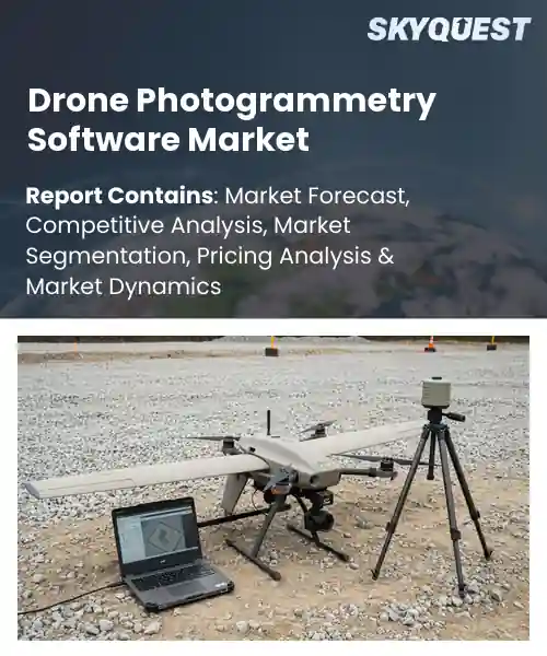
Drone Photogrammetry Software Market
Report ID: SQMIG45E3197
Report ID: SQMIG45E3197
[email protected]
USA +1 351-333-4748
Report ID:
SQMIG45E3197 |
Region:
Global |
Published Date: August, 2026
Pages:
157
|Tables:
95
|Figures:
76


Global Drone Photogrammetry Software Market size was valued at USD 2.76 Billion in 2024 and is poised to grow from USD 3.2 Billion in 2025 to USD 10.34 Billion by 2033, growing at a CAGR of 15.8% during the forecast period (2026-2033).
The integration of AI analytics that transform clouds into actionable insights for users is driving Drone Photogrammetry Software Market. As software embeds machine‑learning models for feature extraction, users automatically detect crop stress, monitor infrastructure deformation, or calculate stockpile volumes without interpretation. The cause‑effect chain is clear: richer analytics raise return on investment, prompting industries such as mining and utilities to allocate budgets toward licences and pipelines. Deployments illustrate trend; a European rail operator reduced inspection time by 40 % after adopting a photogrammetry platform, while a U.S. dairy farm leveraged technology to optimize irrigation, unlocking revenue streams and reinforcing market expansion.
How is AI Enhancing Accuracy In The Drone Photogrammetry Software Market?
AI is reshaping drone photogrammetry by automating the most error prone steps of image processing. Machine learning models now identify ground control points with far greater consistency than manual selection while neural networks filter out atmospheric distortion and motion blur. These advances tighten the alignment of overlapping photos producing dense point clouds and more reliable surface models. The market has responded with rapid adoption across construction, agriculture and infrastructure inspection as firms seek faster turn around and fewer field errors. Companies such as Pix4D, DroneDeploy and Agisoft illustrate how AI driven workflows are becoming the new standard for precision mapping.
DroneDeploy in March 2024, released an AI powered automated feature extraction tool that refines building edges and vegetation outlines directly from raw images. The improvement reduces manual editing and boosts model fidelity, accelerating project delivery and reinforcing the market’s shift toward smarter, more accurate mapping solutions.
Market snapshot - (2026-2033)
Global Market Size
USD 2.76 Billion
Largest Segment
Cloud-based
Fastest Growth
Cloud-based
Growth Rate
15.8% CAGR
To get more insights on this market click here to Request a Free Sample Report
Global drone photogrammetry software market is segmented by deployment, application, end user and region. Based on deployment, the market is segmented into Cloud-based and On-premises. Based on application, the market is segmented into Surveying & Mapping, Construction & Infrastructure, Mining, Agriculture, Oil & Gas, Utilities, Environmental Monitoring, Public Safety & Defense and Others. Based on end user, the market is segmented into Government Agencies, Commercial Enterprises and Research & Academic Institutions. Based on region, the market is segmented into North America, Europe, Asia Pacific, Latin America and Middle East & Africa.
Cloud-based deployment segment dominates because it offers scalable processing power that matches the high‑resolution data streams from modern drones, enabling rapid generation of orthomosaics and 3D models. Users benefit from lower upfront investment, automatic updates, and seamless integration with cloud storage, which accelerates project turnaround in diverse operational contexts and enhances collaborative workflows.
Meanwhile, on-premises deployment emerges as the fastest growing because enterprises handling sensitive geospatial data increasingly demand tighter security and custom integration with legacy GIS systems. The need for offline processing and regulatory compliance fuels investment, expanding opportunities for vendors offering robust local‑host solutions that can scale with complex workflows.
Surveying & mapping application segment stands out because it forms the foundational use case for drone photogrammetry, delivering precise topographic data that replaces traditional ground surveys. The ability to quickly produce accurate digital terrain models improves project planning and reduces field labor, making it indispensable for a wide range of stakeholders across multiple industry verticals and client expectations.
Conversely, environmental monitoring application segment emerges as the most rapidly expanding because regulators and NGOs increasingly rely on high‑resolution drone imagery to track climate impacts, biodiversity loss, and pollution sources. Advances in AI‑driven change detection amplify its value, prompting organizations to adopt software that can automate analyses, thereby opening new revenue streams and driving market diversification.
To get detailed segments analysis, Request a Free Sample Report
North America leads the global drone photogrammetry software market due to a convergence of advanced technological capabilities, mature aerospace ecosystems, and strong demand across multiple industry verticals. The United States and Canada host a dense network of research institutions and technology firms that continuously drive innovation in image processing, AI integration, and real‑time analytics. Robust regulatory frameworks provide clear operational guidelines, encouraging commercial deployment in construction, agriculture, and infrastructure inspection. Significant investment in cloud and data‑management platforms further enhances scalability, while a culture of early adoption accelerates market penetration. The region also benefits from strong collaboration between academia and industry, fostering rapid prototyping and the translation of cutting‑edge research into commercial solutions. Additionally, strategic partnerships with defense and energy sectors expand application scopes, reinforcing the market leadership.
Drone Photogrammetry Software Market in the United States benefits from a concentration of leading technology firms and extensive venture capital support that fuels continuous product advancement. Strong integration with cloud services and AI capabilities enables sophisticated mapping solutions for infrastructure, mining, and agriculture. Close collaboration between universities and industry accelerates research translation, while a clear regulatory environment encourages widespread commercial adoption across public and private sectors and governmental initiatives.
Drone Photogrammetry Software Market in Canada is driven by strong governmental incentives and a collaborative ecosystem linking research institutions with emerging startups. Emphasis on sustainable land management and natural resource monitoring creates demand for high‑resolution aerial mapping. Integration with national cloud infrastructures supports scalable data processing, while clear operational guidelines facilitate adoption across forestry, infrastructure inspection, and precision agriculture sectors and environmental compliance to meet evolving regulatory expectations.
Europe experiences rapid expansion of the drone photogrammetry software market as a result of deep engineering expertise, extensive GIS integration, and proactive policy frameworks that encourage aerial data utilization. The region’s strong emphasis on sustainability and infrastructure renewal drives adoption in renewable energy site assessment, urban planning, and heritage conservation. Collaborative networks among leading universities, research labs, and software firms accelerate innovation in image stitching, automated feature extraction, and real‑time analytics. Harmonized regulatory standards across member states simplify cross‑border operations, enabling service providers to scale offerings efficiently. Moreover, substantial public‑sector investment in smart‑city initiatives and precision agriculture creates a fertile environment for advanced mapping solutions, cementing Europe’s position as a dynamic growth hub.
Drone Photogrammetry Software Market in Germany benefits from a robust industrial base and a tradition of precision engineering that fuels high‑quality data processing tools. Strong collaboration between automotive, engineering, and geospatial firms promote advanced algorithm development for complex terrain modeling. Government initiatives supporting digital transformation in construction and energy sectors create consistent demand, while clear regulatory guidance facilitates commercial deployment across infrastructure monitoring and environmental surveying and public safety.
Drone Photogrammetry Software Market in the United Kingdom is expanding swiftly due to strong academic research output and an entrepreneurial ecosystem that rapidly commercializes innovations. Emphasis on smart‑city projects and renewable energy infrastructure drives demand for precise aerial mapping. Flexible regulatory approaches enable quick integration of new sensor technologies, while partnerships between insurers and tech firms open novel applications in risk assessment and asset management for government and private sectors.
Drone Photogrammetry Software Market in France is emerging as a strategic tool for cultural heritage preservation and agricultural optimization. Growing support from regional development programs encourages startups to integrate AI‑driven analytics with aerial imagery. Collaborative projects between universities and tourism agencies foster innovative uses for detailed site documentation, while agri‑tech initiatives promote precise field monitoring, enhancing yield management and resource efficiency and environmental stewardship across multiple French regions.
Asia Pacific is strengthening its position in the drone photogrammetry software market through rapid technology adoption, expansive infrastructure projects, and a burgeoning ecosystem of innovative start‑ups. Nations such as Japan and South Korea prioritize integration of high‑resolution imaging with AI and cloud platforms, enabling sophisticated terrain analysis for disaster management, urban development, and precision agriculture. Government incentives supporting digital transformation accelerate the deployment of aerial mapping solutions in both public and private sectors. Collaborative research initiatives between universities and industry foster continuous improvement in processing algorithms and real‑time data delivery. The region’s focus on scalability and localization of software interfaces further enhances accessibility, positioning Asia Pacific as an emerging leader in advanced geospatial intelligence.
Drone Photogrammetry Software Market in Japan leverages the country’s strong robotics and imaging expertise to deliver highly accurate aerial mapping solutions. Close cooperation between leading electronics manufacturers and geospatial software firms accelerates the development of compact, high‑resolution sensors suitable for varied terrain. Government programs promoting smart‑city initiatives and disaster resilience create consistent demand, while integration with national cloud services ensures efficient data processing and storage for infrastructure inspection and agricultural monitoring.
Drone Photogrammetry Software Market in South Korea is driven by the nation’s rapid digitalization and strong semiconductor industry, which supports advanced sensor miniaturization. Collaboration between telecom providers and software developers enables real‑time data transmission and cloud‑based analytics for construction, mining, and environmental monitoring. Government incentives for smart‑infrastructure and precision farming encourage widespread adoption, while localized language support and integration with regional GIS platforms enhance usability for domestic enterprises.
To know more about the market opportunities by region and country, click here to
Buy The Complete Report
Increasing Adoption of UAVs
Advancements in Processing Algorithms
Regulatory Restrictions on Drone Flights
High Cost of Specialized Software
Request Free Customization of this report to help us to meet your business objectives.
The competitive landscape is shaped by intense rivalry among established software vendors and emerging players that accelerate innovation through strategic acquisitions, joint ventures, and integration of AI‑driven processing. Recent market drivers include the push for faster, higher‑resolution 3‑D models, prompting firms to acquire niche analytics startups and partner with UAV manufacturers to bundle hardware‑software solutions, thereby enhancing end‑user value and locking in ecosystem loyalty.
SkyQuest’s ABIRAW (Advanced Business Intelligence, Research & Analysis Wing) is our Business Information Services team that Collects, Collates, Correlates, and Analyses the Data collected by means of Primary Exploratory Research backed by robust Secondary Desk research.
As per SkyQuest analysis, the market is being propelled primarily by the rising adoption of UAVs across construction, agriculture and surveying, which fuels demand for photogrammetry software. A second strong driver is the rapid advancement of AI‑enabled processing algorithms that boost accuracy and cut turnaround time. However, stringent aviation regulations limiting drone flights act as a notable restraint, especially for smaller operators. North America remains the dominant region, benefiting from mature tech ecosystems and supportive policies. Within the market, cloud‑based deployment leads the segment share by offering scalable, collaborative processing that accelerates project delivery. These trends position the industry for robust growth through 2033 as enterprises increasingly rely on real‑time 3D insights for decision‑making.
| Report Metric | Details |
|---|---|
| Market size value in 2024 | USD 2.76 Billion |
| Market size value in 2033 | USD 10.34 Billion |
| Growth Rate | 15.8% |
| Base year | 2024 |
| Forecast period | (2026-2033) |
| Forecast Unit (Value) | USD Billion |
| Segments covered |
|
| Regions covered | North America (US, Canada), Europe (Germany, France, United Kingdom, Italy, Spain, Rest of Europe), Asia Pacific (China, India, Japan, Rest of Asia-Pacific), Latin America (Brazil, Rest of Latin America), Middle East & Africa (South Africa, GCC Countries, Rest of MEA) |
| Companies covered |
|
| Customization scope | Free report customization with purchase. Customization includes:-
|
To get a free trial access to our platform which is a one stop solution for all your data requirements for quicker decision making. This platform allows you to compare markets, competitors who are prominent in the market, and mega trends that are influencing the dynamics in the market. Also, get access to detailed SkyQuest exclusive matrix.
Table Of Content
Executive Summary
Market overview
Parent Market Analysis
Market overview
Market size
KEY MARKET INSIGHTS
COVID IMPACT
MARKET DYNAMICS & OUTLOOK
Market Size by Region
KEY COMPANY PROFILES
Methodology
For the Drone Photogrammetry Software Market, our research methodology involved a mixture of primary and secondary data sources. Key steps involved in the research process are listed below:
1. Information Procurement: This stage involved the procurement of Market data or related information via primary and secondary sources. The various secondary sources used included various company websites, annual reports, trade databases, and paid databases such as Hoover's, Bloomberg Business, Factiva, and Avention. Our team did 45 primary interactions Globally which included several stakeholders such as manufacturers, customers, key opinion leaders, etc. Overall, information procurement was one of the most extensive stages in our research process.
2. Information Analysis: This step involved triangulation of data through bottom-up and top-down approaches to estimate and validate the total size and future estimate of the Drone Photogrammetry Software Market.
3. Report Formulation: The final step entailed the placement of data points in appropriate Market spaces in an attempt to deduce viable conclusions.
4. Validation & Publishing: Validation is the most important step in the process. Validation & re-validation via an intricately designed process helped us finalize data points to be used for final calculations. The final Market estimates and forecasts were then aligned and sent to our panel of industry experts for validation of data. Once the validation was done the report was sent to our Quality Assurance team to ensure adherence to style guides, consistency & design.
Analyst Support
Customization Options
With the given market data, our dedicated team of analysts can offer you the following customization options are available for the Drone Photogrammetry Software Market:
Product Analysis: Product matrix, which offers a detailed comparison of the product portfolio of companies.
Regional Analysis: Further analysis of the Drone Photogrammetry Software Market for additional countries.
Competitive Analysis: Detailed analysis and profiling of additional Market players & comparative analysis of competitive products.
Go to Market Strategy: Find the high-growth channels to invest your marketing efforts and increase your customer base.
Innovation Mapping: Identify racial solutions and innovation, connected to deep ecosystems of innovators, start-ups, academics, and strategic partners.
Category Intelligence: Customized intelligence that is relevant to their supply Markets will enable them to make smarter sourcing decisions and improve their category management.
Public Company Transcript Analysis: To improve the investment performance by generating new alpha and making better-informed decisions.
Social Media Listening: To analyze the conversations and trends happening not just around your brand, but around your industry as a whole, and use those insights to make better Marketing decisions.
REQUEST FOR SAMPLE
 REQUEST FREE CUSTOMIZATION
Global Drone Photogrammetry Software Market size was valued at USD 2.76 Billion in 2024 and is poised to grow from USD 3.2 Billion in 2025 to USD 10.34 Billion by 2033, growing at a CAGR of 15.8% during the forecast period (2026-2033).
The competitive landscape is shaped by intense rivalry among established software vendors and emerging players that accelerate innovation through strategic acquisitions, joint ventures, and integration of AI‑driven processing. Recent market drivers include the push for faster, higher‑resolution 3‑D models, prompting firms to acquire niche analytics startups and partner with UAV manufacturers to bundle hardware‑software solutions, thereby enhancing end‑user value and locking in ecosystem loyalty. 'Pix4D SA', 'Agisoft LLC', 'Trimble Inc.', 'Autodesk, Inc.', 'Esri, Inc.', 'Bentley Systems, Incorporated', 'DroneDeploy, Inc.', 'SimActive Inc.', 'Skycatch, Inc.', '3Dsurvey d.o.o.', 'Propeller Aero Pty Ltd', 'Correlator3D LLC', 'Datumate Ltd.', 'Capturing Reality s.r.o.', 'Delair SAS', 'Hexagon AB', 'GeoCue Group, Inc.', 'ContextCapture (Bentley Systems)', 'OpenDroneMap', 'Sentera, Inc.'
Companies across construction, agriculture, and surveying are increasingly adopting UAVs for data capture, which directly fuels demand for photogrammetry software. The ease of deploying drones reduces field time and labor costs, enabling faster project cycles. As organizations recognize the value of high‑resolution 3D models for planning and monitoring, they prioritize software that can process large image datasets efficiently. This shift toward drone‑centric workflows across multiple geographic regions creates a sustained need for advanced photogrammetry solutions, driving market expansion globally in the industry.
Ai-Driven Automation Accelerates Survey Workflows: The infusion of artificial intelligence into drone photogrammetry software is reshaping data capture, processing, and analysis. Machine‑learning models now autonomously identify optimal flight paths, detect anomalies in real‑time, and streamline point‑cloud generation, reducing manual oversight. These capabilities cut project duration, lower operational costs, and enable rapid delivery of high‑resolution terrain models. As vendors embed AI cores, users experience a shift from labor‑intensive workflows to predictive, self‑optimizing operations that support fast‑paced infrastructure and construction projects globally.
Why does North America Dominate the Global Drone Photogrammetry Software Market? |@12


Want to customize this report? This report can be personalized according to your needs. Our analysts and industry experts will work directly with you to understand your requirements and provide you with customized data in a short amount of time. We offer $1000 worth of FREE customization at the time of purchase.
Feedback From Our Clients


 USA (+1) 351-333-4748