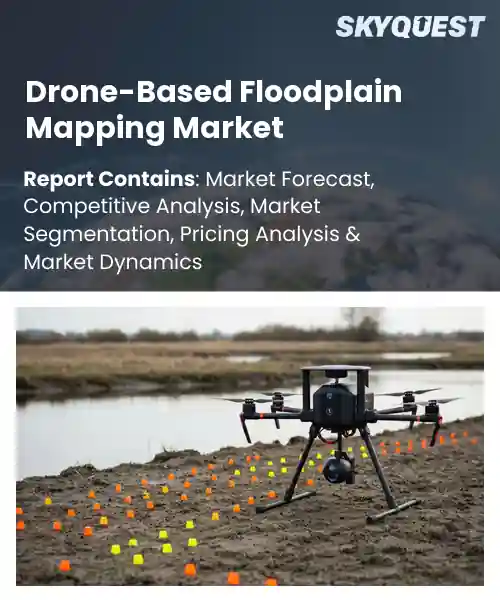
Drone-Based Floodplain Mapping Market
Report ID: SQMIG20Q2053
Report ID: SQMIG20Q2053
[email protected]
USA +1 351-333-4748
Report ID:
SQMIG20Q2053 |
Region:
Global |
Published Date: August, 2026
Pages:
157
|Tables:
120
|Figures:
77


Global Drone-Based Floodplain Mapping Market size was valued at USD 468.0 Million in 2024 and is poised to grow from USD 529.78 Million in 2025 to USD 1428.45 Million by 2033, growing at a CAGR of 13.2% during the forecast period (2026-2033).
Drone-based floodplain mapping market trends uses aerial vehicles fitted with sensors to collect topographic and hydraulic data for flood risk models. The primary market driver is the rising incidence of extreme weather, which compels governments and insurers to seek more accurate, rapid assessments. Traditional surveys depended on ground‑based LiDAR or manual field work, expensive and time‑consuming. Since 2010s, compact UAVs have lowered deployment costs and enabled data capture over remote terrain. After Hurricane Harvey, U.S. Army Corps of Engineers employed quad‑copter surveys, cutting mapping time by 40 percent.
This shift illustrates how heightened regulatory demand and sensor advances have significantly expanded market adoption. The next pivotal factor shaping the drone-based floodplain mapping market growth is integration with analytics platforms that transform raw imagery into predictive flood models. As municipalities adopt smart‑city initiatives, the ability to feed UAV data into GIS and AI engines creates a virtuous cycle: more precise inputs lead to better forecasts, which justify further investment in drone fleets. An example is the Netherlands’ Water Authority, which couples weekly drone sweeps with machine‑learning runoff simulations, reducing flood insurance claims by 15 percent. This synergy unlocks revenue streams for service providers, spurs hardware innovation, and expands market reach into economies facing climate‑related water challenges.
How are AI and IoT Enhancing Accuracy in the Drone-Based Floodplain Mapping Market?
Artificial intelligence and the Internet of Things are reshaping drone-based floodplain mapping market share by turning raw sensor data into precise actionable terrain models. AI algorithms automatically stitch aerial images, detect water boundaries and classify land cover, reducing manual interpretation and error. Meanwhile IoT modules on each drone stream altitude, GPS and atmospheric readings to a cloud platform where they are merged with AI outputs for continuous calibration. The combined workflow delivers higher spatial resolution and up to date flood risk layers that planners can trust. As climate events become more frequent, agencies and insurers are turning to these smart drone systems to plan evacuations and design resilient infrastructure.
In June 2023, DroneDeploy launched an AI and IoT enabled flood mapping service that captures real time sensor feeds and instantly generates high fidelity floodplain models, cutting processing time and improving positional accuracy. This rollout has accelerated adoption of drone solutions across municipal planning and emergency response.
Market snapshot - (2026-2033)
Global Market Size
USD 468.0 Million
Largest Segment
Services
Fastest Growth
Software
Growth Rate
13.2% CAGR
To get more insights on this market click here to Request a Free Sample Report
Global drone-based floodplain mapping market is segmented by offering, drone type, application, end user and region. Based on offering, the market is segmented into hardware, software and services. Based on drone type, the market is segmented into fixed-wing, rotary-wing and hybrid VTOL. Based on application, the market is segmented into flood risk assessment, disaster response, infrastructure planning, environmental monitoring and watershed management. Based on end user, the market is segmented into government agencies, engineering & consulting firms, environmental organizations and research institutions. Based on region, the market is segmented into North America, Europe, Asia Pacific, Latin America and Middle East & Africa.
Hardware segment dominates because it provides the physical platform that captures high‑resolution aerial imagery essential for accurate floodplain delineation. The robustness of rugged frames, extended flight times, and payload capacities enable operators to survey large, water‑logged terrains under challenging conditions. These capabilities directly address the core need for precise topographic data, making hardware the foundational driver of market adoption and sustained investment. Moreover, manufacturers continuously integrate sensor fusion and real‑time telemetry, further enhancing data reliability for downstream analysis.
However, software segment is witnessing the strongest growth momentum because advanced processing algorithms transform raw drone data into actionable flood risk models. Machine‑learning‑driven classification, automated DEM generation, and cloud‑based collaboration tools lower technical barriers, attracting new users and expanding use cases across agencies and consultants, thereby accelerating market expansion.
Rotary‑wing segment dominates because its vertical take‑off and hover capabilities allow precise, low‑altitude surveys over constrained floodplains and near‑shore environments. The agility to maneuver around obstacles and adjust flight paths in real time ensures comprehensive coverage of intricate water channels. This operational flexibility directly meets the demand for detailed, timely mapping during flood events, positioning rotary‑wing platforms as the preferred choice for emergency responders and planners.
Meanwhile, hybrid VTOL segment is emerging as a high‑growth area because it blends the endurance of fixed‑wing flight with the hover precision of rotary‑wing systems. This capability unlocks longer survey ranges while retaining access to tight spots, attracting operators seeking efficiency and versatility, thus fueling adoption and expanding market horizons.
To get detailed segments analysis, Request a Free Sample Report
North America is the largest market for drone-based floodplain mapping, attributed to the presence of advanced technology ecosystems, well-established research institutions, and substantial public sector investment in flood resilience. The United States has a mature aerospace industry that is accelerating sensor mini-technology and data analytics platforms, and regulations that encourage commercial deployment of unmanned aerial systems. This environment is further strengthened by strong environmental monitoring programs and collaborative partnerships between government agencies and technology firms in Canada. The region is a breeding ground for constant innovation, bringing together high-skilled talent, advanced data-processing capacity and proactive water-management policy to become the gold standard for operational excellence and strategic influence across the globe.
Drone-based floodplain mapping market outlook in the United States thrives on close ties between leading aerospace manufacturers and academic research hubs that drive rapid sensor evolution and AI‑enhanced image interpretation. Federal agencies prioritize flood risk reduction, fostering pilot projects that demonstrate operational value. Private firms leverage these insights to offer turnkey services for municipalities, utilities, and insurance providers, reinforcing a cycle of demand, investment, and technical refinement across the sector.
Drone-based floodplain mapping market forecast in Canada is propelled by its strong emphasis on environmental stewardship and collaborative governance models. National research labs work alongside indigenous communities and provincial authorities to tailor aerial surveys that respect diverse ecosystems. Emphasis on open data standards enables seamless integration with existing hydrological databases, while government funding encourages start‑ups to develop rugged platforms suited for cold climates, expanding the practical reach of aerial flood assessment.
Europe’s quickly increasing floodplain mapping by drone is supported by integrated water-management directives, forward-looking aviation regulations and a dense network of technology innovators. Germany leads the way with precision engineering firms offering high-resolution LiDAR and multispectral payloads, while the UK’s liberalized drone policy is driving the uptake of commercial services across urban and rural catchments. The French government’s new emphasis on climate adaptation is leading to public-private research consortia that develop new data-fusion techniques. Joint financing mechanisms and cross-border initiatives further augment knowledge transfer, thereby converting regulatory clarity and sustainability agendas into tangible mapping solutions to underpin resilient infrastructure planning throughout the continent.
Drone-based floodplain mapping market regional outlook in Germany benefits from a heritage of precision engineering and a robust manufacturing base that delivers reliable UAV platforms and sophisticated sensor suites. Collaborative projects between federal water agencies and technical universities drive algorithmic advances for real‑time terrain modeling. Industry clusters facilitate rapid prototyping and scale‑up, while stringent data‑quality standards secure trust among municipalities seeking actionable flood risk insights.
Drone-based floodplain mapping market regional forecast in the United Kingdom advances quickly thanks to a liberal regulatory environment that encourages commercial drone operations over diverse waterways. Academic research institutions partner with start‑ups to refine machine‑learning models that convert aerial imagery into actionable floodplain delineations. Insurance firms and local councils adopt these services to optimize risk assessments, creating a feedback loop that spurs further investment and technology refinement across the sector.
Drone-based floodplain mapping market penetration in France is emerging as a focal point for climate‑adaptation strategies within national policy frameworks. Collaborative labs integrate aerial data with historic hydrological records to enhance predictive modeling. Government incentives support pilot deployments in vulnerable river basins, fostering expertise among engineering consultancies. This growing ecosystem nurtures innovative service offerings that align with broader European sustainability objectives.
Asia Pacific is strengthening its position in drone-based floodplain mapping as a consequence of strategic investments in autonomous flight technologies and a growing awareness of climate-driven flooding risks. Japan draws on its heritage of precision robotics to create compact, high-performing UAVs with advanced imaging sensors, while South Korea combines fast-paced hardware development with cutting-edge software analytics. Resilient infrastructure is a priority for regional governments, so we’ll encourage pilots that showcase how aerial surveying can be cost-effective for disaster-prone districts. Working together, universities and industry speed up knowledge-sharing, and multinational partnerships bring global best practices to local contexts. Together, these initiatives improve the region’s capacity to deliver high-resolution floodplain intelligence on time.
Drone-based floodplain mapping market analysis in Japan draws on a strong robotics heritage and government support for disaster mitigation. Integrated sensor suites and real‑time processing enable detailed elevation models that inform early‑warning systems. Partnerships between municipal agencies and technology firms foster deployment of UAV fleets for routine river monitoring, while academic centers refine algorithms for rapid flood extent estimation. This synergy cultivates a reliable service ecosystem aligned with national safety priorities.
Drone-based floodplain mapping industry in South Korea thrives amid rapid hardware innovation and a proactive approach to smart city planning. Domestic manufacturers supply lightweight drones with high‑resolution imaging, complemented by software platforms that automate terrain analysis for flood risk evaluation. Government initiatives promote pilot projects in metropolitan flood zones, encouraging collaboration between civil engineers and data scientists. The resulting ecosystem delivers scalable, data‑rich solutions that enhance urban resilience and attract regional interest.
To know more about the market opportunities by region and country, click here to
Buy The Complete Report
Growing Demand For Flood Mapping
Advancements In Drone Sensor Technology
Regulatory Restrictions On Airspace Use
Limited Battery Endurance For Large Areas
Request Free Customization of this report to help us to meet your business objectives.
The drone-based flood mapping market is becoming increasingly competitive as surveying, geospatial analytics, drone hardware, and cloud-processing providers expand their capabilities for floodplain delineation and disaster-response applications. Companies are differentiating through high-resolution LiDAR and photogrammetry, multispectral imaging, automated terrain modelling, cloud-based processing, and integration with GIS platforms. Strategic partnerships with governments, engineering firms, insurers, and emergency-response organizations are also becoming important as customers seek faster flood-extent mapping, terrain data, and actionable risk information from aerial surveys.
Top Player’s Company Profile
Recent Developments in the Drone-Based Floodplain Mapping Market
SkyQuest’s ABIRAW (Advanced Business Intelligence, Research & Analysis Wing) is our Business Information Services team that Collects, Collates, Correlates, and Analyses the Data collected by means of Primary Exploratory Research backed by robust Secondary Desk research. As per SkyQuest analysis, the global drone‑based floodplain mapping market is being propelled primarily by the rising demand for rapid, high‑resolution flood mapping as extreme weather events become more frequent, while a second important catalyst is the continual advancement of drone sensor technology that delivers cheaper, more precise LiDAR and multispectral data. The market’s growth is tempered by regulatory restrictions on airspace use, which add permitting complexity and delay projects. North America remains the dominant region, benefiting from a mature aerospace ecosystem and strong public‑sector investment, and the hardware segment leads the market because robust UAV platforms and payloads are essential for capturing the detailed terrain information that drives all downstream applications.
| Report Metric | Details |
|---|---|
| Market size value in 2024 | USD 468.0 Million |
| Market size value in 2033 | USD 1428.45 Million |
| Growth Rate | 13.2% |
| Base year | 2024 |
| Forecast period | (2026-2033) |
| Forecast Unit (Value) | USD Million |
| Segments covered |
|
| Regions covered | North America (US, Canada), Europe (Germany, France, United Kingdom, Italy, Spain, Rest of Europe), Asia Pacific (China, India, Japan, Rest of Asia-Pacific), Latin America (Brazil, Rest of Latin America), Middle East & Africa (South Africa, GCC Countries, Rest of MEA) |
| Companies covered |
|
| Customization scope | Free report customization with purchase. Customization includes:-
|
To get a free trial access to our platform which is a one stop solution for all your data requirements for quicker decision making. This platform allows you to compare markets, competitors who are prominent in the market, and mega trends that are influencing the dynamics in the market. Also, get access to detailed SkyQuest exclusive matrix.
Table Of Content
Executive Summary
Market overview
Parent Market Analysis
Market overview
Market size
KEY MARKET INSIGHTS
COVID IMPACT
MARKET DYNAMICS & OUTLOOK
Market Size by Region
KEY COMPANY PROFILES
Methodology
For the Drone-Based Floodplain Mapping Market, our research methodology involved a mixture of primary and secondary data sources. Key steps involved in the research process are listed below:
1. Information Procurement: This stage involved the procurement of Market data or related information via primary and secondary sources. The various secondary sources used included various company websites, annual reports, trade databases, and paid databases such as Hoover's, Bloomberg Business, Factiva, and Avention. Our team did 45 primary interactions Globally which included several stakeholders such as manufacturers, customers, key opinion leaders, etc. Overall, information procurement was one of the most extensive stages in our research process.
2. Information Analysis: This step involved triangulation of data through bottom-up and top-down approaches to estimate and validate the total size and future estimate of the Drone-Based Floodplain Mapping Market.
3. Report Formulation: The final step entailed the placement of data points in appropriate Market spaces in an attempt to deduce viable conclusions.
4. Validation & Publishing: Validation is the most important step in the process. Validation & re-validation via an intricately designed process helped us finalize data points to be used for final calculations. The final Market estimates and forecasts were then aligned and sent to our panel of industry experts for validation of data. Once the validation was done the report was sent to our Quality Assurance team to ensure adherence to style guides, consistency & design.
Analyst Support
Customization Options
With the given market data, our dedicated team of analysts can offer you the following customization options are available for the Drone-Based Floodplain Mapping Market:
Product Analysis: Product matrix, which offers a detailed comparison of the product portfolio of companies.
Regional Analysis: Further analysis of the Drone-Based Floodplain Mapping Market for additional countries.
Competitive Analysis: Detailed analysis and profiling of additional Market players & comparative analysis of competitive products.
Go to Market Strategy: Find the high-growth channels to invest your marketing efforts and increase your customer base.
Innovation Mapping: Identify racial solutions and innovation, connected to deep ecosystems of innovators, start-ups, academics, and strategic partners.
Category Intelligence: Customized intelligence that is relevant to their supply Markets will enable them to make smarter sourcing decisions and improve their category management.
Public Company Transcript Analysis: To improve the investment performance by generating new alpha and making better-informed decisions.
Social Media Listening: To analyze the conversations and trends happening not just around your brand, but around your industry as a whole, and use those insights to make better Marketing decisions.
REQUEST FOR SAMPLE
 REQUEST FREE CUSTOMIZATION
Global Drone-Based Floodplain Mapping Market size was valued at USD 468.0 Million in 2024 and is poised to grow from USD 529.78 Million in 2025 to USD 1428.45 Million by 2033, growing at a CAGR of 13.2% during the forecast period (2026-2033).
The competitive landscape is shaped by rapid adoption of high‑resolution LiDAR drones, with firms racing to secure exclusive data partnerships with municipal agencies and to integrate real‑time analytics platforms; recent M&A activity, such as a leading geospatial software company acquiring a niche flood‑modeling startup, underscores the drive to bundle mapping services with predictive flood risk tools, while joint ventures between drone manufacturers and cloud‑processing providers accelerate technology rollout and differentiate service offerings. 'DroneDeploy, Inc.', 'Pix4D SA', 'AgEagle Aerial Systems Inc.', 'Delair SAS', 'Wingtra AG', 'DJI Technology Co., Ltd.', 'Parrot Drones SAS', 'Trimble Inc.', 'Esri, Inc.', 'Nearmap Ltd.', 'Quantum Systems GmbH', 'FlyGuys, Inc.', 'Skycatch, Inc.', 'DroneBase, Inc.', 'senseFly SA', 'Terra Drone Corporation', 'Airobotics Ltd.', 'Flyability SA', 'GeoCue Group Inc.', 'YellowScan SAS'
The rising frequency of extreme weather events compels governments and infrastructure managers to seek rapid, high‑resolution floodplain assessments, and drone‑based solutions deliver timely, detailed topographic data without extensive ground crews. This capability shortens project timelines, reduces field personnel exposure, and improves decision‑making for mitigation planning, thereby encouraging agencies to allocate budgets toward aerial surveying platforms. As stakeholders recognize the operational efficiencies and enhanced situational awareness offered by unmanned aerial systems, adoption accelerates, directly driving market expansion for drone‑based floodplain mapping services.
Ai‑Driven Data Fusion: Integrating advanced AI algorithms with high‑resolution drone imagery enables seamless fusion of topographic, hydrological, and land‑use datasets. This capability reduces manual preprocessing, accelerates map generation, and improves predictive accuracy for floodplain delineation. Vendors are embedding machine‑learning models that automatically identify water‑affected zones, vegetation changes, and sediment deposition, allowing stakeholders to obtain actionable insights within hours rather than days. The shift toward AI‑driven workflows is expanding market adoption among municipal planners, insurance analysts, and infrastructure developers seeking rapid, data‑rich flood risk assessments.
Why does North America Dominate the Global Drone-Based Floodplain Mapping Market? |@12


Want to customize this report? This report can be personalized according to your needs. Our analysts and industry experts will work directly with you to understand your requirements and provide you with customized data in a short amount of time. We offer $1000 worth of FREE customization at the time of purchase.
Feedback From Our Clients


 USA (+1) 351-333-4748