Global Airborne LiDAR Market

Global Airborne LiDAR Market Size, Share, Growth Analysis, By Type(Topographic LiDAR, Bathymetric LiDAR), By Platform(Fixed-wing Aircraft, Rotary-wing Aircraft), By Component(Lasers, Inertial Navigation Systems (INS)) - Industry Forecast 2024-2031


Report ID: SQMIG45I2182 | Region: Global | Published Date: April, 2024
Pages: 197 | Tables: 94 | Figures: 76

Global Airborne LiDAR Market Insights

Global Airborne LiDAR Market size was valued at USD 6.84 billion in 2022 and is poised to grow from USD 7.22 billion in 2023 to USD 11.09 billion by 2031, growing at a CAGR of 5.52% in the forecast period (2024-2031).

In recent years, the Airborne LiDAR world market has experienced considerable changes in demands caused by technological development, widening applications of the devices across industry branches, and rising requirements for 3D mapping and surveying systems.

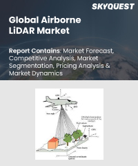
Airborne LiDAR technology is used in many areas of practice such as the forestry industry, agricultural sector, civil planning, construction sector, and environmental monitoring, among others. Airborne LiDAR serves as a major driving force, ensuring that there is a high demand for quality and detailed spatial information data.

The market is driven by constant innovations in LiDAR sensors such as increased precision, longer range, and tighter point spacing. Combining LiDAR with other technologies including AI, ML increases data proficiency towards a wide spectrum of usage.

Nevertheless, though the market is developing, factors like high startup expenses and intricate data processing algorithms could slow down the adoption rates. They include the development of cheaper LiDARs and other novel fields like infrastructure inspection and urban planning towards the intelligent city.

Moreover, government initiatives on environmental surveillance, emergency response and road construction have also boosted this acceptance of airborne LiDAR.

Typically, LiDAR is employed in government-driven projects with regards terrain modeling, floodplain mapping, and surveillance of nature conservation.

Market snapshot - 2024-2031

Global Market Size

USD 6.84 billion

Largest Segment

Topographic LiDAR

Fastest Growth

Bathymetric LiDAR

Growth Rate

5.52% CAGR

Global Airborne Lidar Market ($ Bn)
Country Share for North America Region (%)
Global Airborne Lidar Market By Type($ Bn)
Global Airborne Lidar Market By Type (%)

To get more reports on the above market click here to Buy The Report

Global Airborne LiDAR Market Segmental Analysis

The global airborne LiDAR market is segmented into four major segments i.e. by type of system, platform type, component, and region. Based on type, it is divided into topographic LiDAR, bathymetric LiDAR, topobathymetric LiDAR, and others. Based on platform type, it is bifurcated as fixed-wing aircraft, rotary-wing aircraft, UAVs (Unmanned Aerial Vehicles), and ground-based. Based on components it is segregated into lasers, inertial navigation systems (INS), GPS/GNSS receivers, cameras, and others. Based on region, the market is segmented into North America, Europe, Asia-Pacific, Latin America, Middle East and Africa.

Analysis by Type

Topographic LiDAR has had a large market share due to its use in terrain mapping, surveys, and planning for infrastructural purposes. It has a high accuracy level because it can determine detailed elevation details which make it important in various areas such as urban planning, environment observation, and natural resources. There could be a growing demand for high-definition topographical information in applications such as smart city creation, precision agricultural methods, and construction of infrastructures; ultimately propelling the uptake of topographic LiDAR systems.

The fastest developing method of acquiring bathymetry data called bathymetric LiDAR is a must-have tool for underwater mapping, coastal zone management, and marine resources exploration. Such applications are essential for hydrography and coastal engineering. The increasing attention to the understanding and governance of coasts and sea may lead to increased requirements of bathymetric LiDAR. The drivers include climate change adaptation, resource exploration among others.

Analysis by Platform

Over the years, fixed-wing aircraft have been used extensively in large-scale mapping projects on a wide scale, thus dominating the global Airborne LiDAR. These machines have greater range and fly for long time spans allowing them to be used for tasks such as aeromagnetic surveying, topographic studies, and map production.

It is the fastest growing market segment because they provide high manoeuvrability and enable access to tricky terrain, which are suitable for detailed, closely defined mapping within confined or remote areas. Rotary-wing aircraft are very flexible and best fits in forestry, urban planning and relief missions after a disaster. Adoption increased in the above mentioned sectors can drive the growth of helicopter platforms.

Global Airborne Lidar Market By Type, 2022 (%)

To get detailed analysis on other segments, Request For Free Sample Report

Global Airborne LiDAR Market Regional Insights

Airborne LiDAR technology is predominantly developed and used in North America. Major technology firms, world-leading research institutions and relevant government agencies are based in this region with a notable presence of research geared towards supporting LiDAR technology application. Continuous investment in infrastructure development, environmental monitoring and growing application of LiDAR in the agricultural and forestry sectors also have a great potential of increasing demand for airborne LiDAR in the region.

The economic growth in the Asia Pacific that has translated into more urbanization, infrastructure and also, agriculture related activities. Due to this, there remains a need for accuracy in geospatial data leading to the use of LiDAR technology. Emerging economies will continue investing in infrastructure development as well as smart city initiatives in the region thereby creating immense opportunities for fast growth in the airborne LiDAR market of Asia Pacific.

Global Airborne Lidar Market By Region, 2024-2031
  • Largest
  • Fastest

To know more about the market opportunities by region and country, click here to
Buy The Complete Report

Global Airborne LiDAR Market Dynamics

Drivers

Increasing Demand for High-precision Geospatial Data

  • Rise in demand for highly accurate geospatial information especially for use in urban planning, construction of infrastructure and the environment. With highly precise three-dimensional mapping and geospatial capabilities, this technology is essential for everything from forestry management to geology. The technological advancement of the capacity of light detection and ranging (LiDAR) sensors, for instance, the enhancement of data accuracy, expansion of range and a higher point density, results in an increased range of application

Restraints

High Initial Costs Associated with Deploying LiDAR Systems

  • Among the major hindrances of this market is the huge costs involved in purchasing and deployment of the LiDAR-based devices. However, initial capital requirements on equipment and technology may prove an obstacle, especially with tiny companies in low budget settings. Secondly, data processing workflows are complicated because one has to interpret and use huge data produced by the airborne LiDAR system. In addition, regulatory restrictions on data collection and use together with privacy implications might confine the applications especially in the delicate areas. The intermittent availability of skilled professionals adept at handling LiDAR technology is another restraint, as the industry demands a specialized skill set for effective implementation.

Request Free Customization of this report to help us to meet your business objectives.

Global Airborne LiDAR Market Competitive Landscape

Airborne LiDAR market is highly competitive with various prominent participants fighting for a share in the market and technological leadership. Significant players in this field are established technology firms as well as emerging start-ups contributing towards development and diversifying of LiDAR applications. To stay ahead of established companies in the market, leading companies continuously innovate, develop products, participate in partnerships, etc. Airborne LiDAR systems are enhanced by significant investment in research and development to improve their capability levels and standards.

Top Player’s Company Profiles

  • Teledyne Technologies
  • Leica Geosystems (Hexagon AB)
  • Trimble Inc.
  • Fugro
  • IGI Systems
  • FARO Technologies Inc.
  • Riegl Laser Measurement Systems GmbH
  • SICK AG
  • YellowScan
  • Quantum Spatial
  • GeoDigital International Inc.
  • Optech International Inc.
  • Velodyne LiDAR Inc.
  • GeoEye
  • Vertex Aerospace
  • Airborne Imaging LLC
  • C&J Aerial Photography
  • Woolpert
  • Merrick & Company
  • Photomapping Services Pty Ltd.

Recent Developments

  • In March 2024, Leica Geosystems, part of Hexagon, launched the Leica TerrainMapper-3 airborne Lidar sensor, featuring new scan pattern configurability to support the widest variety of applications and requirements in a single system.  
  • In February 2024, JOUAV released the JoLiDAR-1000 Lidar sensor designed specifically for uncrewed aerial vehicles (UAVs or ‘drones’) as the latest addition to its array of high-performance Lidar sensors for use in UAV applications such as GIS, surveying and precision powerline inspections. 
  • In June 2023, RIEGL Laser Measurement Systems GmbH and Schiebel successfully completed the integration of a laser scanning system, the RIEGL VQ-840-G topo-bathymetric lidar sensor, on the Schiebel CAMCOPTER S-100 UAS. The RIEGL VQ-840-G, combined with the technical specifications and performance of the CAMCOPTER S-100 UAS, enables an efficient and secure way for surveying shallow waters, where monitoring from boats becomes a challenge.

Global Airborne LiDAR Key Market Trends

Rising Integration of LiDAR with Artificial Intelligence (AI) and Machine Learning (ML) Applications

  • The growing convergence between LiDAR systems with AI/ML techniques and associated applications. This improves data processing capabilities leading to easier and automated information extractions from the LiDAR-developed datasets. In addition, there is a transition towards small-sized and lighter designs of LiDAR sensors, integrating them onboard UAVs for better mobility as well as accessibility in varied settings. Recent trends in the use of air-borne LiDAR technology in environmental programs and climate change initiatives. Lista de 3. Airborne LiDAR contributes immensely to tracking environmental degradation through deforestation, documenting biota diversity, and assisting in the planning of climate change resilience strategies among many other uses.

Global Airborne LiDAR Market SkyQuest Analysis

SkyQuest’s ABIRAW (Advanced Business Intelligence, Research & Analysis Wing) is our Business Information Services team that Collects, Collates, Correlates, and Analyses the Data collected by means of Primary Exploratory Research backed by robust Secondary Desk research.

Global airborne LiDAR market analysis reveals a dynamic marketplace with several standout trends and difficulties. This market is being driven by the upsurge of the need for high-precision geospatial data within different areas of business to use it for Urban planning and infrastructure construction. However, they entail higher initial costs and more complex data processing workflow present barriers to their widespread adoption. The study of product type shows that the topobathymetric LiDAR system provides a variety of functions allowing mapping of ground and seafloor simultaneously.

Technology developments and smart cities have driven market leadership in the region of North America. For these key trends, some issues include the incorporation of LiDAR with AI, moving towards more complex and sustainable methods to address ever-changing market needs.

Report Metric Details
Market size value in 2022 USD 6.84 billion
Market size value in 2031 USD 11.09 billion
Growth Rate 5.52%
Base year 2023
Forecast period 2024-2031
Forecast Unit (Value) USD Billion
Segments covered
  • Type
    • Topographic LiDAR, Bathymetric LiDAR, Topobathymetric LiDAR, and Others
  • Platform
    • Fixed-wing Aircraft, Rotary-wing Aircraft, UAVs (Unmanned Aerial Vehicles), and Ground-based
  • Component
    • Lasers, Inertial Navigation Systems (INS), GPS/GNSS Receivers, Cameras, and Others
Regions covered North America (US, Canada), Europe (Germany, France, United Kingdom, Italy, Spain, Rest of Europe), Asia Pacific (China, India, Japan, Rest of Asia-Pacific), Latin America (Brazil, Rest of Latin America), Middle East & Africa (South Africa, GCC Countries, Rest of MEA)
Companies covered
  • Teledyne Technologies
  • Leica Geosystems (Hexagon AB)
  • Trimble Inc.
  • Fugro
  • IGI Systems
  • FARO Technologies Inc.
  • Riegl Laser Measurement Systems GmbH
  • SICK AG
  • YellowScan
  • Quantum Spatial
  • GeoDigital International Inc.
  • Optech International Inc.
  • Velodyne LiDAR Inc.
  • GeoEye
  • Vertex Aerospace
  • Airborne Imaging LLC
  • C&J Aerial Photography
  • Woolpert
  • Merrick & Company
  • Photomapping Services Pty Ltd.
Customization scope

Free report customization with purchase. Customization includes:-

  • Segments by type, application, etc
  • Company profile
  • Market dynamics & outlook
  • Region

To get a free trial access to our platform which is a one stop solution for all your data requirements for quicker decision making. This platform allows you to compare markets, competitors who are prominent in the market, and mega trends that are influencing the dynamics in the market. Also, get access to detailed SkyQuest exclusive matrix.

Buy The Complete Report to read the analyzed strategies adopted by the top vendors either to retain or gain market share

Table Of Content

Executive Summary

Market overview

  • Exhibit: Executive Summary – Chart on Market Overview
  • Exhibit: Executive Summary – Data Table on Market Overview
  • Exhibit: Executive Summary – Chart on Global Airborne LiDAR Market Characteristics
  • Exhibit: Executive Summary – Chart on Market by Geography
  • Exhibit: Executive Summary – Chart on Market Segmentation
  • Exhibit: Executive Summary – Chart on Incremental Growth
  • Exhibit: Executive Summary – Data Table on Incremental Growth
  • Exhibit: Executive Summary – Chart on Vendor Market Positioning

Parent Market Analysis

Market overview

Market size

  • Market Dynamics
    • Exhibit: Impact analysis of DROC, 2021
      • Drivers
      • Opportunities
      • Restraints
      • Challenges
  • SWOT Analysis

KEY MARKET INSIGHTS

  • Technology Analysis
    • (Exhibit: Data Table: Name of technology and details)
  • Pricing Analysis
    • (Exhibit: Data Table: Name of technology and pricing details)
  • Supply Chain Analysis
    • (Exhibit: Detailed Supply Chain Presentation)
  • Value Chain Analysis
    • (Exhibit: Detailed Value Chain Presentation)
  • Ecosystem Of the Market
    • Exhibit: Parent Market Ecosystem Market Analysis
    • Exhibit: Market Characteristics of Parent Market
  • IP Analysis
    • (Exhibit: Data Table: Name of product/technology, patents filed, inventor/company name, acquiring firm)
  • Trade Analysis
    • (Exhibit: Data Table: Import and Export data details)
  • Startup Analysis
    • (Exhibit: Data Table: Emerging startups details)
  • Raw Material Analysis
    • (Exhibit: Data Table: Mapping of key raw materials)
  • Innovation Matrix
    • (Exhibit: Positioning Matrix: Mapping of new and existing technologies)
  • Pipeline product Analysis
    • (Exhibit: Data Table: Name of companies and pipeline products, regional mapping)
  • Macroeconomic Indicators

COVID IMPACT

  • Introduction
  • Impact On Economy—scenario Assessment
    • Exhibit: Data on GDP - Year-over-year growth 2016-2022 (%)
  • Revised Market Size
    • Exhibit: Data Table on Global Airborne LiDAR Market size and forecast 2021-2027 ($ million)
  • Impact Of COVID On Key Segments
    • Exhibit: Data Table on Segment Market size and forecast 2021-2027 ($ million)
  • COVID Strategies By Company
    • Exhibit: Analysis on key strategies adopted by companies

MARKET DYNAMICS & OUTLOOK

  • Market Dynamics
    • Exhibit: Impact analysis of DROC, 2021
      • Drivers
      • Opportunities
      • Restraints
      • Challenges
  • Regulatory Landscape
    • Exhibit: Data Table on regulation from different region
  • SWOT Analysis
  • Porters Analysis
    • Competitive rivalry
      • Exhibit: Competitive rivalry Impact of key factors, 2021
    • Threat of substitute products
      • Exhibit: Threat of Substitute Products Impact of key factors, 2021
    • Bargaining power of buyers
      • Exhibit: buyers bargaining power Impact of key factors, 2021
    • Threat of new entrants
      • Exhibit: Threat of new entrants Impact of key factors, 2021
    • Bargaining power of suppliers
      • Exhibit: Threat of suppliers bargaining power Impact of key factors, 2021
  • Skyquest special insights on future disruptions
    • Political Impact
    • Economic impact
    • Social Impact
    • Technical Impact
    • Environmental Impact
    • Legal Impact

Market Size by Region

  • Chart on Market share by geography 2021-2027 (%)
  • Data Table on Market share by geography 2021-2027(%)
  • North America
    • Chart on Market share by country 2021-2027 (%)
    • Data Table on Market share by country 2021-2027(%)
    • USA
      • Exhibit: Chart on Market share 2021-2027 (%)
      • Exhibit: Market size and forecast 2021-2027 ($ million)
    • Canada
      • Exhibit: Chart on Market share 2021-2027 (%)
      • Exhibit: Market size and forecast 2021-2027 ($ million)
  • Europe
    • Chart on Market share by country 2021-2027 (%)
    • Data Table on Market share by country 2021-2027(%)
    • Germany
      • Exhibit: Chart on Market share 2021-2027 (%)
      • Exhibit: Market size and forecast 2021-2027 ($ million)
    • Spain
      • Exhibit: Chart on Market share 2021-2027 (%)
      • Exhibit: Market size and forecast 2021-2027 ($ million)
    • France
      • Exhibit: Chart on Market share 2021-2027 (%)
      • Exhibit: Market size and forecast 2021-2027 ($ million)
    • UK
      • Exhibit: Chart on Market share 2021-2027 (%)
      • Exhibit: Market size and forecast 2021-2027 ($ million)
    • Rest of Europe
      • Exhibit: Chart on Market share 2021-2027 (%)
      • Exhibit: Market size and forecast 2021-2027 ($ million)
  • Asia Pacific
    • Chart on Market share by country 2021-2027 (%)
    • Data Table on Market share by country 2021-2027(%)
    • China
      • Exhibit: Chart on Market share 2021-2027 (%)
      • Exhibit: Market size and forecast 2021-2027 ($ million)
    • India
      • Exhibit: Chart on Market share 2021-2027 (%)
      • Exhibit: Market size and forecast 2021-2027 ($ million)
    • Japan
      • Exhibit: Chart on Market share 2021-2027 (%)
      • Exhibit: Market size and forecast 2021-2027 ($ million)
    • South Korea
      • Exhibit: Chart on Market share 2021-2027 (%)
      • Exhibit: Market size and forecast 2021-2027 ($ million)
    • Rest of Asia Pacific
      • Exhibit: Chart on Market share 2021-2027 (%)
      • Exhibit: Market size and forecast 2021-2027 ($ million)
  • Latin America
    • Chart on Market share by country 2021-2027 (%)
    • Data Table on Market share by country 2021-2027(%)
    • Brazil
      • Exhibit: Chart on Market share 2021-2027 (%)
      • Exhibit: Market size and forecast 2021-2027 ($ million)
    • Rest of South America
      • Exhibit: Chart on Market share 2021-2027 (%)
      • Exhibit: Market size and forecast 2021-2027 ($ million)
  • Middle East & Africa (MEA)
    • Chart on Market share by country 2021-2027 (%)
    • Data Table on Market share by country 2021-2027(%)
    • GCC Countries
      • Exhibit: Chart on Market share 2021-2027 (%)
      • Exhibit: Market size and forecast 2021-2027 ($ million)
    • South Africa
      • Exhibit: Chart on Market share 2021-2027 (%)
      • Exhibit: Market size and forecast 2021-2027 ($ million)
    • Rest of MEA
      • Exhibit: Chart on Market share 2021-2027 (%)
      • Exhibit: Market size and forecast 2021-2027 ($ million)

KEY COMPANY PROFILES

  • Competitive Landscape
    • Total number of companies covered
      • Exhibit: companies covered in the report, 2021
    • Top companies market positioning
      • Exhibit: company positioning matrix, 2021
    • Top companies market Share
      • Exhibit: Pie chart analysis on company market share, 2021(%)

Methodology

For the Global Airborne LiDAR Market, our research methodology involved a mixture of primary and secondary data sources. Key steps involved in the research process are listed below:

1. Information Procurement: This stage involved the procurement of Market data or related information via primary and secondary sources. The various secondary sources used included various company websites, annual reports, trade databases, and paid databases such as Hoover's, Bloomberg Business, Factiva, and Avention. Our team did 45 primary interactions Globally which included several stakeholders such as manufacturers, customers, key opinion leaders, etc. Overall, information procurement was one of the most extensive stages in our research process.

2. Information Analysis: This step involved triangulation of data through bottom-up and top-down approaches to estimate and validate the total size and future estimate of the Global Airborne LiDAR Market.

3. Report Formulation: The final step entailed the placement of data points in appropriate Market spaces in an attempt to deduce viable conclusions.

4. Validation & Publishing: Validation is the most important step in the process. Validation & re-validation via an intricately designed process helped us finalize data points to be used for final calculations. The final Market estimates and forecasts were then aligned and sent to our panel of industry experts for validation of data. Once the validation was done the report was sent to our Quality Assurance team to ensure adherence to style guides, consistency & design.

Analyst Support

Customization Options

With the given market data, our dedicated team of analysts can offer you the following customization options are available for the Global Airborne LiDAR Market:

Product Analysis: Product matrix, which offers a detailed comparison of the product portfolio of companies.

Regional Analysis: Further analysis of the Global Airborne LiDAR Market for additional countries.

Competitive Analysis: Detailed analysis and profiling of additional Market players & comparative analysis of competitive products.

Go to Market Strategy: Find the high-growth channels to invest your marketing efforts and increase your customer base.

Innovation Mapping: Identify racial solutions and innovation, connected to deep ecosystems of innovators, start-ups, academics, and strategic partners.

Category Intelligence: Customized intelligence that is relevant to their supply Markets will enable them to make smarter sourcing decisions and improve their category management.

Public Company Transcript Analysis: To improve the investment performance by generating new alpha and making better-informed decisions.

Social Media Listening: To analyze the conversations and trends happening not just around your brand, but around your industry as a whole, and use those insights to make better Marketing decisions.

$5,300
BUY NOW GET FREE SAMPLE
Want to customize this report?

Our industry expert will work with you to provide you with customized data in a short amount of time.

REQUEST FREE CUSTOMIZATION

FAQs

Global Airborne LiDAR Market size was valued at USD 6.84 billion in 2022 and is poised to grow from USD 7.22 billion in 2023 to USD 11.09 billion by 2031, growing at a CAGR of 5.52% in the forecast period (2024-2031).

Airborne LiDAR market is highly competitive with various prominent participants fighting for a share in the market and technological leadership. Significant players in this field are established technology firms as well as emerging start-ups contributing towards development and diversifying of LiDAR applications. To stay ahead of established companies in the market, leading companies continuously innovate, develop products, participate in partnerships, etc. Airborne LiDAR systems are enhanced by significant investment in research and development to improve their capability levels and standards. 'Teledyne Technologies', 'Leica Geosystems (Hexagon AB)', 'Trimble Inc.', 'Fugro', 'IGI Systems', 'FARO Technologies Inc.', 'Riegl Laser Measurement Systems GmbH', 'SICK AG', 'YellowScan', 'Quantum Spatial', 'GeoDigital International Inc.', 'Optech International Inc.', 'Velodyne LiDAR Inc.', 'GeoEye', 'Vertex Aerospace', 'Airborne Imaging LLC', 'C&J Aerial Photography', 'Woolpert', 'Merrick & Company', 'Photomapping Services Pty Ltd.'

Rise in demand for highly accurate geospatial information especially for use in urban planning, construction of infrastructure and the environment. With highly precise three-dimensional mapping and geospatial capabilities, this technology is essential for everything from forestry management to geology. The technological advancement of the capacity of light detection and ranging (LiDAR) sensors, for instance, the enhancement of data accuracy, expansion of range and a higher point density, results in an increased range of application

The growing convergence between LiDAR systems with AI/ML techniques and associated applications. This improves data processing capabilities leading to easier and automated information extractions from the LiDAR-developed datasets. In addition, there is a transition towards small-sized and lighter designs of LiDAR sensors, integrating them onboard UAVs for better mobility as well as accessibility in varied settings. Recent trends in the use of air-borne LiDAR technology in environmental programs and climate change initiatives. Lista de 3. Airborne LiDAR contributes immensely to tracking environmental degradation through deforestation, documenting biota diversity, and assisting in the planning of climate change resilience strategies among many other uses.

Airborne LiDAR technology is predominantly developed and used in North America. Major technology firms, world-leading research institutions and relevant government agencies are based in this region with a notable presence of research geared towards supporting LiDAR technology application. Continuous investment in infrastructure development, environmental monitoring and growing application of LiDAR in the agricultural and forestry sectors also have a great potential of increasing demand for airborne LiDAR in the region.

Request Free Customization

Want to customize this report? This report can be personalized according to your needs. Our analysts and industry experts will work directly with you to understand your requirements and provide you with customized data in a short amount of time. We offer $1000 worth of FREE customization at the time of purchase.

logo-images

Feedback From Our Clients

Global Airborne LiDAR Market

Product ID: SQMIG45I2182

$5,300
BUY NOW GET FREE SAMPLE