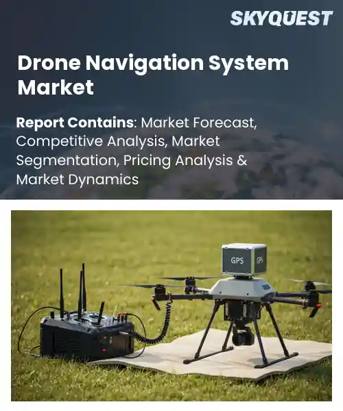
Drone Navigation System Market
Report ID: SQMIG20I2831
Report ID: SQMIG20I2831
[email protected]
USA +1 351-333-4748
Report ID:
SQMIG20I2831 |
Region:
Global |
Published Date: April, 2026
Pages:
157
|Tables:
118
|Figures:
77


Global Drone Navigation System Market size was valued at USD 4.42 Billion in 2024 and is poised to grow from USD 5.23 Billion in 2025 to USD 4.4 Billion by 2033, growing at a CAGR of 18.4% during the forecast period (2026-2033).
Drone navigation system market centers on hardware and software that enable unmanned aerial vehicles to determine position, plan routes, avoid obstacles, and maintain stable flight. Its primary driver is the convergence of affordable sensors, robust GNSS augmentation, and advanced onboard processing that together reduce navigation error and increase autonomy. This market matters because precise navigation unlocks commercial applications from agriculture mapping and infrastructure inspection to logistics and emergency response, transforming efficiency and safety. Historically, development moved from basic GPS guidance toward sensor fusion and visual-inertial odometry, exemplified by companies integrating LiDAR and computer vision to operate reliably in GPS-denied environments.A pivotal factor shaping global drone navigation system market is the maturation of onboard AI and sensor fusion, because higher autonomy reduces operator burden and expands viable commercial deployments. As navigation systems grow more reliable, logistics firms pilot beyond-visual-line-of-sight delivery programs like those tested by retailers, which in turn drives demand for certified navigation stacks and redundancy. Similarly, utilities adopt autonomous inspection using LiDAR and thermal cameras, causing service providers to invest in scalable navigation software and cloud-based fleet management. Regulatory bodies consequently establish performance standards, which further legitimizes investment and accelerates partnerships between OEMs, software vendors, and enterprise customers.
How is AI enhancing accuracy and safety in the drone navigation system market?
AI enhances accuracy and safety in drone navigation by combining sensor fusion, vision based obstacle avoidance, adaptive path planning and resilient localization in GPS denied environments. Onboard machine learning interprets camera and LiDAR inputs to predict hazards and choose safer routes in real time. Edge AI reduces latency compared with remote control and adds layered redundancy so a single failure does not cause mission loss. The current market favors enterprise and defense customers who demand dependable autonomy for inspections public safety and logistics, so vendors are shipping software driven updates and integrated sensor suites to meet those needs and build operational trust.Skydio March 2026, issued a Cayley firmware update that improved onboard autonomy and adaptive link management which sharpens obstacle avoidance and mission continuity. That AI driven enhancement increases operational reliability and lowers the need for constant human intervention supporting broader enterprise adoption and more efficient field operations.
Market snapshot - (2026-2033)
Global Market Size
USD 4.42 Billion
Largest Segment
Satellite Navigation (GNSS/GPS/Galileo)
Fastest Growth
Vision-based Navigation & SLAM
Growth Rate
18.4% CAGR
To get more insights on this market click here to Request a Free Sample Report
Global drone navigation system market is segmented by navigation technology, component layer, autonomy level, end-use vertical and region. Based on navigation technology, the market is segmented into Satellite Navigation (GNSS/GPS/Galileo), Inertial Navigation Systems (INS/IMU), Vision-based Navigation & SLAM and LiDAR & Obstacle Avoidance Systems. Based on component layer, the market is segmented into Flight Controllers & Processors, Sensor Suites (Accelerometers/Gyros) and Ground Control Stations (GCS) Software. Based on autonomy level, the market is segmented into Remotely Piloted (Manual), Semi-autonomous (Waypoint/Follow-me) and Fully Autonomous (Beyond Visual Line of Sight - BVLOS). Based on end-use vertical, the market is segmented into Military & Defense (Tactical Navigation), Logistics & Delivery Drones and Industrial Inspection & Agriculture. Based on region, the market is segmented into North America, Europe, Asia Pacific, Latin America and Middle East & Africa.
Vision-based Navigation & SLAM segment dominates because it provides drones with rich environmental perception allowing robust localization in GPS-denied or complex environments. Machine learning and camera fusion improve feature extraction and loop closure, which reduces drift and enables precise path following. This capability drives adoption in applications requiring close-proximity operations and dynamic obstacle negotiation, creating demand for integrated perception stacks and higher compute capacity within navigation platforms.
However, Satellite Navigation (GNSS/GPS/Galileo) is the most rapidly expanding area due to continual enhancements in multi-constellation reliability and certification pathways that encourage integration into commercial airworthiness frameworks. Its ubiquitous reference frame reduces integration friction for payload vendors and accelerates enterprise deployment across logistics and inspection use cases, opening avenues for standardized positioning services.
Fully Autonomous (Beyond Visual Line of Sight - BVLOS) segment leads because it enables extended missions and reduces human intervention, transforming operational models across inspections, delivery, and surveillance. Advances in redundant navigation stacks, integrated sense and avoid, and regulatory acceptance create conditions for safe long-range operations, prompting investment in resilient hardware and software. This leadership arises from the capability to unlock new commercial workflows previously constrained by visual line of sight limits.
However, Semi-autonomous (Waypoint/Follow-me) is witnessing the strongest growth as operators prioritize predictable automation that reduces pilot workload while fitting existing operational frameworks. Technology maturation in mission planning, intuitive interfaces, and interoperability with ground control systems accelerates adoption across inspection and delivery services, creating scalable pathways to higher autonomy and incremental regulatory acceptance.
To get detailed segments analysis, Request a Free Sample Report
North America leads due to a confluence of advanced technological ecosystems, deep defense and commercial aerospace demand, and mature regulatory frameworks that enable safe integration of unmanned systems. A dense network of research institutions and well funded private companies accelerates innovation in sensor fusion, autonomous guidance, and secure communications. Strong collaboration between government agencies, military programs, and commercial enterprises drives practical deployment and iterative improvements. Robust supply chains and access to venture capital support rapid commercialization, while established standards bodies help harmonize interoperability. The market benefits from diverse end users, ranging from infrastructure inspection to logistics and public safety, ensuring sustained investment in navigation accuracy, redundancy, and cybersecurity. Extensive test ranges and experienced systems integrators provide practical validation environments, while policy support encourages trials and public private partnerships that translate prototypes into operational solutions.
Drone Navigation System Market United States benefits from concentration of aerospace contractors, defense programs, and commercial innovators that drive advanced navigation capabilities. A robust ecosystem of sensor developers, software firms, and systems integrators supports rapid prototyping and deployment. Close collaboration with federal agencies and national test facilities enables validation of navigation solutions across complex operational scenarios, reinforcing leadership in reliable, secure, and scalable guidance systems for military and civilian applications.
Drone Navigation System Market Canada features collaboration among research institutions, technology firms, and resource sector operators seeking precise aerial navigation for remote operations. Emphasis on robust cold weather performance and long range planning shapes development priorities. Partnerships with suppliers and national agencies promote integration of resilient positioning, navigation, and timing solutions into surveying, environmental monitoring, and infrastructure inspection workflows, fostering advancement of software defined navigation capabilities across remote resource sectors.
Asia Pacific expansion is driven by strong adoption across commercial, industrial, and public service sectors, supported by national strategies that prioritize automation and smart infrastructure. Rapid improvements in semiconductor and sensor manufacturing in regional hubs lower barriers to advanced navigation hardware, while local software capabilities refine algorithms for complex urban and coastal environments. Increasing investment in logistics, agriculture, and disaster management applications creates abundant use cases that accelerate deployment and tailoring of solutions. Regulatory bodies in key markets are progressively enabling beyond visual line of sight operations and innovation corridors, encouraging pilot projects and public private partnerships. Collaboration between global vendors and domestic firms fosters transfer of expertise and scale, positioning the region as a dynamic growth arena for navigation technologies.
Drone Navigation System Market Japan leverages a dense manufacturing base and precision engineering that support miniaturized, reliable navigation components. Domestic firms collaborate with research institutes to optimize algorithms for urban corridors and maritime approaches. Integration with automation in logistics and precision agriculture provides testing grounds, while government led initiatives encourage safe integration and interoperability, accelerating commercialization of resilient navigation platforms adapted to local operational environments and coastal surveillance applications domestically.
Drone Navigation System Market South Korea is driven by strong electronics manufacturing capabilities and semiconductor design expertise that support performance navigation chips and sensors. Collaboration between conglomerates, startups, and research centers accelerates integration of inertial measurement units, vision navigation, and secure communication layers. Government programs promoting smart logistics, urban air mobility pilots, and industrial inspection use cases create local demand that sharpens system reliability and interoperability for regional deployments regionally.
Europe is strengthening its role through coordinated regulatory frameworks, investment in resilient supply chains, and emphasis on interoperability across member markets. A strong industrial base in aerospace, defense, and research institutions underpins innovation in fault tolerant navigation, multi sensor fusion, and secure data links. Focused initiatives promote harmonized standards and testing corridors that facilitate cross border trials and commercial scale up. Collaboration among established manufacturers, niche technology vendors, and urban mobility planners accelerates integration for infrastructure inspection, logistics, and emergency response. Strategic procurement by public agencies and partnerships with academic centers cultivate talent and validate solutions in varied operational contexts, enhancing regional competitiveness in safe and certified navigation systems. Supportive funding and innovation networks help startups scale, while cross sector pilots in urban mobility reinforce needs for accuracy and redundancy. Engagement with international partners advances export potential for certified navigation solutions.
Drone Navigation System Market Germany draws on engineering expertise and a strong supplier network that enable modular, industrial navigation systems. Presence of automation, automotive, and aerospace sectors drives demand for robust sensor fusion and industrial certification. Collaboration among firms, research centers, and standards bodies supports testing and harmonization. Pilots in manufacturing inspection and critical infrastructure monitoring provide operational feedback that refines system resilience and maintenance practices across industrial segments nationally.
Drone Navigation System Market United Kingdom is supported by research universities and innovative software and avionics firms focused on secure, certified navigation solutions. Emphasis on urban air mobility, commercial drone services, and emergency response stimulates integration of redundant positioning and cyber resilient architectures. Public sector procurement and test range availability encourage validation. Industry academia partnerships accelerate standards development and pilot deployments, helping domestic suppliers mature products for international markets abroad.
Drone Navigation System Market France draws on aerospace heritage and a network of specialized suppliers advancing precision navigation and certification processes. Research laboratories and test centers support resilient sensor fusion and fault tolerant systems for complex terrain and maritime environments. Collaboration with defense, transportation, and utility sectors ensures practical application and standards alignment. Pilot programs in inspection and emergency services refine operational concepts and drive adoption of proven navigation solutions.
To know more about the market opportunities by region and country, click here to
Buy The Complete Report
Advancements In Positioning Technology
Integration With Autonomous Systems
Regulatory Complexity and Restrictions
High Integration and Maintenance Costs
Request Free Customization of this report to help us to meet your business objectives.
Competitive pressure in the global drone navigation system market centers on rapid technology differentiation and tactical consolidation. Incumbents pursue bolt on acquisitions and integrations, for example AeroVironment's acquisition of Planck, while challengers push edge autonomy and sensor fusion innovations. Partnerships and tech licensing drive win strategies, evidenced by Opteran's integrations for GPS denied indoor navigation and Tycho.AI's government contracts and Series A to scale edge navigation.
Top Player’s Company Profile
Recent Developments
SkyQuest’s ABIRAW (Advanced Business Intelligence, Research & Analysis Wing) is our Business Information Services team that Collects, Collates, Correlates, and Analyses the Data collected by means of Primary Exploratory Research backed by robust Secondary Desk research. As per SkyQuest analysis, a key driver of the global drone navigation system market is advancements in positioning technology such as multi-sensor fusion and GNSS augmentation that improve reliability and enable complex missions. A second driver is integration with autonomous systems, which reduces operator burden and unlocks BVLOS and large-scale commercial deployments. However regulatory complexity and varying airspace rules remain a major restraint, slowing deployments and cross-border scaling. North America dominates the market due to deep aerospace and defense ecosystems and supportive test infrastructure, while vision-based navigation and SLAM are the dominating segment thanks to superior environmental perception and robust localization in GPS-denied environments.
| Report Metric | Details |
|---|---|
| Market size value in 2024 | USD 4.42 Billion |
| Market size value in 2033 | USD 4.4 Billion |
| Growth Rate | 18.4% |
| Base year | 2024 |
| Forecast period | (2026-2033) |
| Forecast Unit (Value) | USD Billion |
| Segments covered |
|
| Regions covered | North America (US, Canada), Europe (Germany, France, United Kingdom, Italy, Spain, Rest of Europe), Asia Pacific (China, India, Japan, Rest of Asia-Pacific), Latin America (Brazil, Rest of Latin America), Middle East & Africa (South Africa, GCC Countries, Rest of MEA) |
| Companies covered |
|
| Customization scope | Free report customization with purchase. Customization includes:-
|
To get a free trial access to our platform which is a one stop solution for all your data requirements for quicker decision making. This platform allows you to compare markets, competitors who are prominent in the market, and mega trends that are influencing the dynamics in the market. Also, get access to detailed SkyQuest exclusive matrix.
Table Of Content
Executive Summary
Market overview
Parent Market Analysis
Market overview
Market size
KEY MARKET INSIGHTS
COVID IMPACT
MARKET DYNAMICS & OUTLOOK
Market Size by Region
KEY COMPANY PROFILES
Methodology
For the Drone Navigation System Market, our research methodology involved a mixture of primary and secondary data sources. Key steps involved in the research process are listed below:
1. Information Procurement: This stage involved the procurement of Market data or related information via primary and secondary sources. The various secondary sources used included various company websites, annual reports, trade databases, and paid databases such as Hoover's, Bloomberg Business, Factiva, and Avention. Our team did 45 primary interactions Globally which included several stakeholders such as manufacturers, customers, key opinion leaders, etc. Overall, information procurement was one of the most extensive stages in our research process.
2. Information Analysis: This step involved triangulation of data through bottom-up and top-down approaches to estimate and validate the total size and future estimate of the Drone Navigation System Market.
3. Report Formulation: The final step entailed the placement of data points in appropriate Market spaces in an attempt to deduce viable conclusions.
4. Validation & Publishing: Validation is the most important step in the process. Validation & re-validation via an intricately designed process helped us finalize data points to be used for final calculations. The final Market estimates and forecasts were then aligned and sent to our panel of industry experts for validation of data. Once the validation was done the report was sent to our Quality Assurance team to ensure adherence to style guides, consistency & design.
Analyst Support
Customization Options
With the given market data, our dedicated team of analysts can offer you the following customization options are available for the Drone Navigation System Market:
Product Analysis: Product matrix, which offers a detailed comparison of the product portfolio of companies.
Regional Analysis: Further analysis of the Drone Navigation System Market for additional countries.
Competitive Analysis: Detailed analysis and profiling of additional Market players & comparative analysis of competitive products.
Go to Market Strategy: Find the high-growth channels to invest your marketing efforts and increase your customer base.
Innovation Mapping: Identify racial solutions and innovation, connected to deep ecosystems of innovators, start-ups, academics, and strategic partners.
Category Intelligence: Customized intelligence that is relevant to their supply Markets will enable them to make smarter sourcing decisions and improve their category management.
Public Company Transcript Analysis: To improve the investment performance by generating new alpha and making better-informed decisions.
Social Media Listening: To analyze the conversations and trends happening not just around your brand, but around your industry as a whole, and use those insights to make better Marketing decisions.
REQUEST FOR SAMPLE
 REQUEST FREE CUSTOMIZATION


Want to customize this report? This report can be personalized according to your needs. Our analysts and industry experts will work directly with you to understand your requirements and provide you with customized data in a short amount of time. We offer $1000 worth of FREE customization at the time of purchase.
Feedback From Our Clients


 USA (+1) 351-333-4748