
Inspect Global
Ground truth for Every
Asset
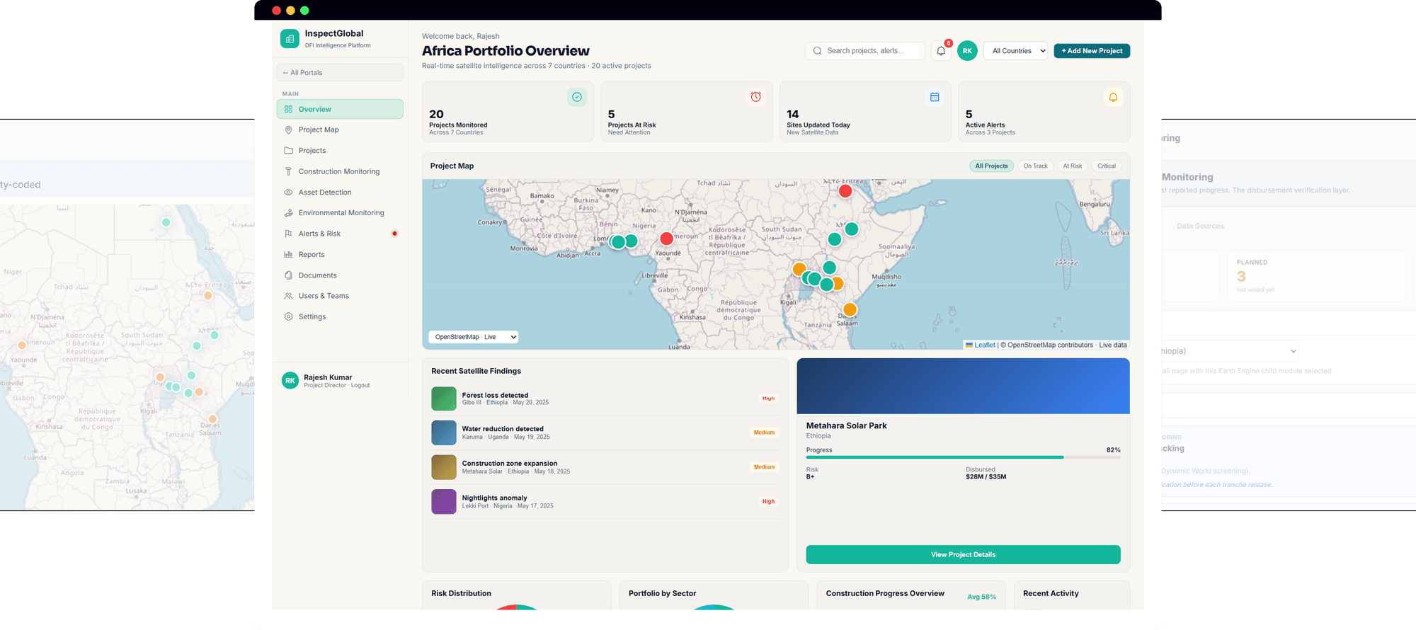
InspectGlobal fuses satellite, GPS, drones, IoT, and AI into one verified record of progress, risk, and compliance so decisions don't rely on someone's word.
0+
Active Projects
0M
TCO₂e Generated
0M USD
Finance Mobilized
0+
Active Projects
0M
TCO₂e Generated
0M USD
Finance Mobilized
One Verified Record,Instead Of Nine Disconnected Reports
InspectGlobal fuses satellite, GPS, drone, and IoT data into a single AI-reconciled fusion score per site so no funding decision relies on one party's word.
Independent verification
satellite cross-checks self-reported progress
Disagreement flags
e.g.Satellite vs Drone:78% vs 82%
Evidence certificates
blockchain-anchored, ready for tranche releases
Compliance alerts
live deforestation, turbidity, and emissions monitoring
Features
Built For The Verification, Not Just
Visualization
Every module is designed to answer one question: does the evidence on the ground match what's being reported and if not, where exactly is the gap?
Satellite Construction Monitoring
Monthly composite imagery with YOLOv8 + SAM object detection identifies bulldozers, cranes, dump trucks, and more matched automatically against GPS fleet counts.
Live GPS Fleet Intelligence
Track every excavator, grader, and dump truck in real time. AI classifies activity active grading, idle, unauthorized exit and corroborates it against satellite passes.
Multi-Source Fusion Scoring
Nine independent sources satellite, GPS, IoT, drone, cameras, edge AI, acoustic, physical inspection are weighted and combined into one auditable fusion score per site.
Environmental Compliance Alerts
Automated deforestation detection against AMDAL boundaries, water turbidity thresholds, and clearance status (MoEF Stage I/II) surfaced as live alerts, not quarterly reports.
Tamper-Proof Evidence Certificates
Milestone completions are anchored on-chain, giving DFIs and lenders a verifiable record to release loan tranches against without waiting on manual audit reports.
Portfolio & Risk Dashboards
Role-based views for investors and underwriters surface AI-scored project health, deformation risk (InSAR), and projected returns across an entire asset portfolio.
How It Works
From Raw Signal To Verified
Record
Four stages turn scattered sensor and imagery feeds into a single number that funders, regulators, and operators can act on.
1. Ingest every source
Satellite passes (Sentinel, Planet, Landsat), GPS telemetry, IoT sensor streams, drone orthomosaics, and site cameras are pulled in continuously, on their own native schedules.
2. Run AI detection & classification
Computer vision models (YOLOv8, SAM, SatLas) detect and count equipment, vehicles, and structures. GPS streams are classified into activity types grading, transport, idle, breakdown.
3. Cross-check & flag gaps
Every detection is matched against the equivalent reading from other sources. Mismatches "12 light vehicles on satellite vs 14 on GPS" are surfaced as disagreements, not hidden.
4. Score , certify & alert
A weighted fusion score is computed per site. Verified milestones generate blockchain certificates; environmental or safety threshold breaches push alerts to the right role immediately.
Use Cases
One Platform, Six Very
Different Jobs
From dynamic field monitoring to automated enterprise verification, InspectGlobal fits into the workflows that matter most.

Release Loan Tranches On Verified Milestones
A DFI loan officer needs to confirm 78% physical progress before releasing Tranche 4 on an industrial park loan without flying someone out.
Satellite imagery cross-checked against GPS and drone data
Independent progress % generated for each milestone
Evidence certificate issued for the disbursement record

Catch Compliance Breaches In Days, Not Months
Track land clearing, emissions, and water quality against approved limits automatically, continuously.
Continuous monitoring against permitted site boundaries
AI flags excess clearance, emissions, or water quality breaches
Alerts routed to the relevant agency within 48 hours

Price Risk On Live Conditions, Not Last Year's Survey
Pull current structural and environmental data for any asset under an active policy.
Millimeter-precision deformation tracking via InSAR
Structural movement compared against safe tolerances
Risk data refreshed on every satellite pass, not annually

Know Your Fleet's Status Without Walking The Site
See equipment activity, idle time, and location across every site in your portfolio.
Live GPS tracking of every machine, classified by activity
Idle, low-fuel, and off-route equipment flagged automatically
Geofence alerts for unauthorized movement, day or night

One Score Across Every Project, Every Geography
Replace inconsistent contractor reporting with a single comparable progress and risk score.
AI-generated fusion score for each asset in the portfolio
Consistent scoring methodology across geographies and sectors
Portfolio-level trends updated as new data arrives

Benchmark Claimed Progress Against The Imagery
Reconcile contractor-reported progress with what satellite and drone imagery actually shows.
Monthly composite imagery compared to reported milestones
Variance between claimed and observed progress quantified
Discrepancies flagged automatically for follow-up review
Six Roles, One Shared Source
Of Truth
InspectGlobal ships with role-based portals, so each stakeholder sees the data fused for their decisions not a generic dashboard they have to interpret themselves.
Government Officers
Monitor national infrastructure portfolios satellite evidence, GPS fleets, environmental compliance, and deforestation alerts across every project.
DFI Loan Analysts
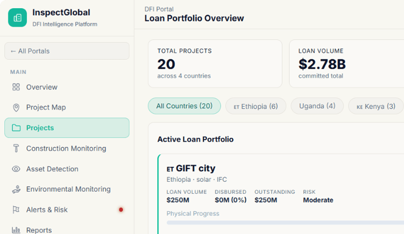
Verify tranche conditions against satellite evidence, monitor the loan portfolio, and issue blockchain certificates for milestone-based releases.
Investors
Track portfolio performance with AI-scored project progress, risk assessments, and projected returns across every asset type in one place.
Field Inspectors
GPS fleet tracking, IoT sensor monitoring, drone mission management, and on-site data aggregation built for daily operational use.
Insurance Underwriters
Satellite-verified risk assessment for active claims, including InSAR deformation data, GPS anomaly reports, and environmental compliance records.
Satellite Analysts
Full access to every analysis tool construction progress, vehicle detection, deforestation monitoring, and change detection across the whole platform.
Featured Case Studies
Impact Stories That Speak for Themselves
Real engagements. Real numbers. Real transformation across industries, geographies and business challenges.


FAQ
Frequently Asked Questions.
Insight
From Insight To Action
Discover thought leadership designed to help organisations make smarter decisions, scale innovation, and create measurable impact.


Stay Ahead with Our Weekly
Intelligence Brief
Industry insights, market research, and strategic thinking curated for leaders who move first.